

Landeveisbirken CLONED FROM ROUTE 1034069
A cycling route starting in Rena, Hedmark, Norway.
Overview
About this route
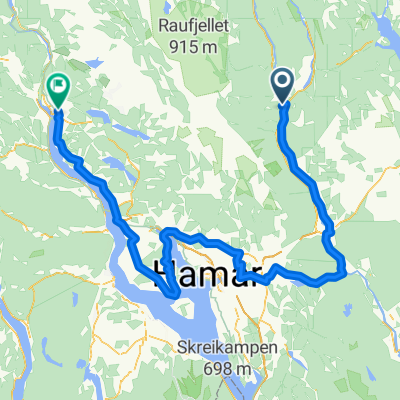
Landveisbirken
Rute for Landeveisbirken 2012
Oppdatert 21.5.2012
Vi stoler desverre ikke på programmets anslag på vertikale høydemetre.
- -:--
- Duration
- 172 km
- Distance
- 943 m
- Ascent
- 925 m
- Descent
- ---
- Avg. speed
- ---
- Max. altitude
Route quality
Waytypes & surfaces along the route
Waytypes
Cycleway
17.2 km
(10 %)
Road
8.6 km
(5 %)
Surfaces
Paved
123.9 km
(72 %)
Unpaved
6.9 km
(4 %)
Asphalt
123.9 km
(72 %)
Gravel
6.9 km
(4 %)
Undefined
41.3 km
(24 %)
Continue with Bikemap
Use, edit, or download this cycling route
You would like to ride Landeveisbirken CLONED FROM ROUTE 1034069 or customize it for your own trip? Here is what you can do with this Bikemap route:
Free features
- Save this route as favorite or in collections
- Copy & plan your own version of this route
- Split it into stages to create a multi-day tour
- Sync your route with Garmin or Wahoo
Premium features
Free trial for 3 days, or one-time payment. More about Bikemap Premium.
- Navigate this route on iOS & Android
- Export a GPX / KML file of this route
- Create your custom printout (try it for free)
- Download this route for offline navigation
Discover more Premium features.
Get Bikemap PremiumFrom our community
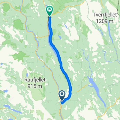
Other popular routes starting in Rena
 06-rest
- Distance
- 769.3 km
- Ascent
- 7,108 m
- Descent
- 7,341 m
- Location
- Rena, Hedmark, Norway
 Landeveisbirken CLONED FROM ROUTE 1034069
- Distance
- 172 km
- Ascent
- 943 m
- Descent
- 925 m
- Location
- Rena, Hedmark, Norway
 Birkebeienrrittet 2010
- Distance
- 91.1 km
- Ascent
- 1,190 m
- Descent
- 1,147 m
- Location
- Rena, Hedmark, Norway

 LV Birken CLONED FROM ROUTE 1029315
- Distance
- 168.6 km
- Ascent
- 1,094 m
- Descent
- 1,072 m
- Location
- Rena, Hedmark, Norway
 Rena-Akrestrommen
- Distance
- 70.8 km
- Ascent
- 398 m
- Descent
- 357 m
- Location
- Rena, Hedmark, Norway
 Turbirken 86 km
- Distance
- 85 km
- Ascent
- 1,237 m
- Descent
- 1,143 m
- Location
- Rena, Hedmark, Norway
 Landeveisbirken CLONED FROM ROUTE 1034069
- Distance
- 172.1 km
- Ascent
- 933 m
- Descent
- 915 m
- Location
- Rena, Hedmark, Norway
Open it in the app