

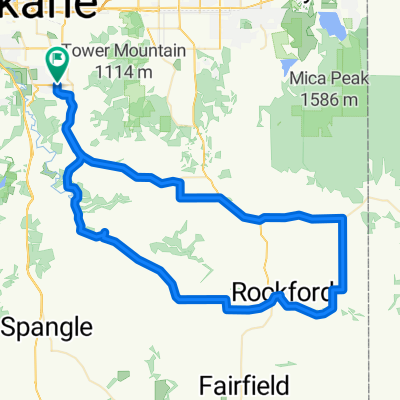
South hill tour
A cycling route starting in Spokane, Washington, United States.
Overview
About this route
- -:--
- Duration
- 18.3 km
- Distance
- 175 m
- Ascent
- 162 m
- Descent
- ---
- Avg. speed
- ---
- Max. altitude
Route quality
Waytypes & surfaces along the route
Waytypes
Quiet road
6.9 km
(38 %)
Road
2 km
(11 %)
Surfaces
Paved
10 km
(55 %)
Unpaved
0.2 km
(1 %)
Asphalt
10 km
(55 %)
Gravel
0.2 km
(1 %)
Undefined
8 km
(44 %)
Route highlights
Points of interest along the route
Point of interest after 7.9 km
Point of interest after 8.2 km
Point of interest after 15.7 km
Point of interest after 15.8 km
Point of interest after 16.9 km
Continue with Bikemap
Use, edit, or download this cycling route
You would like to ride South hill tour or customize it for your own trip? Here is what you can do with this Bikemap route:
Free features
- Save this route as favorite or in collections
- Copy & plan your own version of this route
- Sync your route with Garmin or Wahoo
Premium features
Free trial for 3 days, or one-time payment. More about Bikemap Premium.
- Navigate this route on iOS & Android
- Export a GPX / KML file of this route
- Create your custom printout (try it for free)
- Download this route for offline navigation
Discover more Premium features.
Get Bikemap PremiumFrom our community
Other popular routes starting in Spokane
 Spokane to Liberty Lake loop
- Distance
- 59.7 km
- Ascent
- 74 m
- Descent
- 81 m
- Location
- Spokane, Washington, United States
 Spokane - Okanogan
- Distance
- 233.2 km
- Ascent
- 1,065 m
- Descent
- 1,391 m
- Location
- Spokane, Washington, United States
 Upper South Hill scenic urban ride
- Distance
- 29.3 km
- Ascent
- 46 m
- Descent
- 60 m
- Location
- Spokane, Washington, United States
 My south lill ride
- Distance
- 19.8 km
- Ascent
- 1,156 m
- Descent
- 1,158 m
- Location
- Spokane, Washington, United States
 60 km palouse
- Distance
- 60.7 km
- Ascent
- 450 m
- Descent
- 450 m
- Location
- Spokane, Washington, United States
 Long Valley Chapel Loop
- Distance
- 78.2 km
- Ascent
- 992 m
- Descent
- 992 m
- Location
- Spokane, Washington, United States
 spangle/cheney/medical lake
- Distance
- 112.2 km
- Ascent
- 545 m
- Descent
- 545 m
- Location
- Spokane, Washington, United States
 kendall yards to downriver
- Distance
- 7.1 km
- Ascent
- 55 m
- Descent
- 79 m
- Location
- Spokane, Washington, United States
Open it in the app