

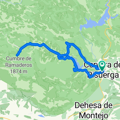
Valsadornin - EL GOLOBAR - Aguilar de Campoo - Valsadornin
A cycling route starting in Cervera de Pisuerga, Castille and León, Spain.
Overview
About this route
Valsadornin - Rueda de Pisuerga - Brañosera - EL GOLOBAR - Cillamayor - Aguilar de Campoo - Perazancas - Valsadornin.
- -:--
- Duration
- 108.6 km
- Distance
- 1,828 m
- Ascent
- 1,828 m
- Descent
- ---
- Avg. speed
- ---
- Max. altitude

Route quality
Waytypes & surfaces along the route
Waytypes
Road
54.3 km
(50 %)
Cycleway
4.3 km
(4 %)
Surfaces
Paved
85.8 km
(79 %)
Unpaved
1.1 km
(1 %)
Asphalt
85.8 km
(79 %)
Unpaved (undefined)
1.1 km
(1 %)
Undefined
21.7 km
(20 %)
Continue with Bikemap
Use, edit, or download this cycling route
You would like to ride Valsadornin - EL GOLOBAR - Aguilar de Campoo - Valsadornin or customize it for your own trip? Here is what you can do with this Bikemap route:
Free features
- Save this route as favorite or in collections
- Copy & plan your own version of this route
- Split it into stages to create a multi-day tour
- Sync your route with Garmin or Wahoo
Premium features
Free trial for 3 days, or one-time payment. More about Bikemap Premium.
- Navigate this route on iOS & Android
- Export a GPX / KML file of this route
- Create your custom printout (try it for free)
- Download this route for offline navigation
Discover more Premium features.
Get Bikemap PremiumFrom our community
Other popular routes starting in Cervera de Pisuerga
 Tag 4 von Cervera de Pisuera nach Mediana de Pomar
- Distance
- 112.7 km
- Ascent
- 634 m
- Descent
- 1,055 m
- Location
- Cervera de Pisuerga, Castille and León, Spain
 cervera-vidrieros-puertos de riofrio-ledantes
- Distance
- 56.6 km
- Ascent
- 1,059 m
- Descent
- 1,262 m
- Location
- Cervera de Pisuerga, Castille and León, Spain
 Fuente Deshondonada
- Distance
- 31.2 km
- Ascent
- 320 m
- Descent
- 320 m
- Location
- Cervera de Pisuerga, Castille and León, Spain
 Ruta pantanos. Montaña palentina. Cervera-Cervera
- Distance
- 97 km
- Ascent
- 727 m
- Descent
- 708 m
- Location
- Cervera de Pisuerga, Castille and León, Spain
 Cervera de pisuerga
- Distance
- 103.7 km
- Ascent
- 1,058 m
- Descent
- 1,062 m
- Location
- Cervera de Pisuerga, Castille and León, Spain
 Etapa 1 . Vuelta a la Montaña Palentina . Cervera/Camasobres
- Distance
- 46.7 km
- Ascent
- 1,451 m
- Descent
- 1,261 m
- Location
- Cervera de Pisuerga, Castille and León, Spain
 Lechetronica 2013
- Distance
- 163.7 km
- Ascent
- 0 m
- Descent
- 0 m
- Location
- Cervera de Pisuerga, Castille and León, Spain
 Valsadornin - EL GOLOBAR - Aguilar de Campoo - Valsadornin
- Distance
- 108.6 km
- Ascent
- 1,828 m
- Descent
- 1,828 m
- Location
- Cervera de Pisuerga, Castille and León, Spain
Open it in the app