

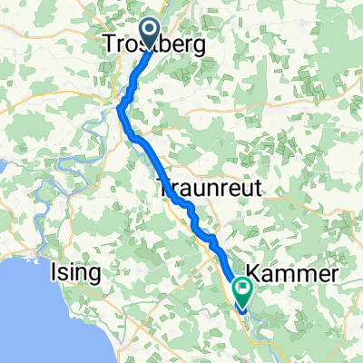
Trostberg-Stein-Dieding-Ort
A cycling route starting in Trostberg an der Alz, Bavaria, Germany.
Overview
About this route
Hin flach, zurück obenrum leicht bergig.
- -:--
- Duration
- 17.5 km
- Distance
- 118 m
- Ascent
- 118 m
- Descent
- ---
- Avg. speed
- ---
- Max. altitude

Route quality
Waytypes & surfaces along the route
Waytypes
Quiet road
8 km
(46 %)
Path
3.5 km
(20 %)
Surfaces
Paved
11.8 km
(68 %)
Unpaved
3.1 km
(18 %)
Asphalt
8.4 km
(48 %)
Paved (undefined)
3.3 km
(19 %)
Continue with Bikemap
Use, edit, or download this cycling route
You would like to ride Trostberg-Stein-Dieding-Ort or customize it for your own trip? Here is what you can do with this Bikemap route:
Free features
- Save this route as favorite or in collections
- Copy & plan your own version of this route
- Sync your route with Garmin or Wahoo
Premium features
Free trial for 3 days, or one-time payment. More about Bikemap Premium.
- Navigate this route on iOS & Android
- Export a GPX / KML file of this route
- Create your custom printout (try it for free)
- Download this route for offline navigation
Discover more Premium features.
Get Bikemap PremiumFrom our community
Other popular routes starting in Trostberg an der Alz
 2-Tagestour Trostberg-Salzburg u. zurück
- Distance
- 17 km
- Ascent
- 125 m
- Descent
- 44 m
- Location
- Trostberg an der Alz, Bavaria, Germany
 SZ-2_Trostberg_Forstern_65,9km 660hm
- Distance
- 65.9 km
- Ascent
- 800 m
- Descent
- 775 m
- Location
- Trostberg an der Alz, Bavaria, Germany
 Tachinger See Runde
- Distance
- 53.4 km
- Ascent
- 643 m
- Descent
- 629 m
- Location
- Trostberg an der Alz, Bavaria, Germany
 Trostberg-Stein-Dieding-Ort
- Distance
- 17.5 km
- Ascent
- 118 m
- Descent
- 118 m
- Location
- Trostberg an der Alz, Bavaria, Germany
 Bavaria to Rome - Part One
- Distance
- 162.7 km
- Ascent
- 413 m
- Descent
- 335 m
- Location
- Trostberg an der Alz, Bavaria, Germany
 Aiging Freilassing
- Distance
- 48.8 km
- Ascent
- 377 m
- Descent
- 436 m
- Location
- Trostberg an der Alz, Bavaria, Germany
 Leichte Nachmittagstour
- Distance
- 27.9 km
- Ascent
- 211 m
- Descent
- 216 m
- Location
- Trostberg an der Alz, Bavaria, Germany
 waginger see66 km
- Distance
- 67.4 km
- Ascent
- 469 m
- Descent
- 468 m
- Location
- Trostberg an der Alz, Bavaria, Germany
Open it in the app