

Tandem Daun Trier-Ruwer CLONED FROM ROUTE 743513
A cycling route starting in Daun, Rhineland-Palatinate, Germany.
Overview
About this route
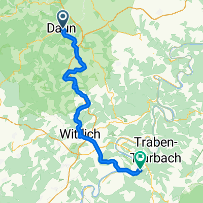
Vom Bahnhof Daun geht es über den Maare Mosel Radweg 53 km zur Mosel und dann 53 km entlang der Mosel nach Trier. Die gesamte Strecke ist asphaltiert. Die Aufzeichnung hört schon in Trier-Ruwer auf weil es anfing zu schütten. Der Maare Mosel Radweg ist wirklich klasse mit zwei Tunnel über 500 Meter. Hier sind auch leichte Anstiege drin aber überwiegend geht es abwärts.
- -:--
- Duration
- 93.7 km
- Distance
- 274 m
- Ascent
- 551 m
- Descent
- ---
- Avg. speed
- ---
- Max. altitude

Continue with Bikemap
Use, edit, or download this cycling route
You would like to ride Tandem Daun Trier-Ruwer CLONED FROM ROUTE 743513 or customize it for your own trip? Here is what you can do with this Bikemap route:
Free features
- Save this route as favorite or in collections
- Copy & plan your own version of this route
- Split it into stages to create a multi-day tour
- Sync your route with Garmin or Wahoo
Premium features
Free trial for 3 days, or one-time payment. More about Bikemap Premium.
- Navigate this route on iOS & Android
- Export a GPX / KML file of this route
- Create your custom printout (try it for free)
- Download this route for offline navigation
Discover more Premium features.
Get Bikemap PremiumFrom our community
Other popular routes starting in Daun
 Maare - Mosel Bahntrasse
- Distance
- 59.7 km
- Ascent
- 400 m
- Descent
- 665 m
- Location
- Daun, Rhineland-Palatinate, Germany
 Dauner Runde 1. Teil
- Distance
- 75.1 km
- Ascent
- 886 m
- Descent
- 877 m
- Location
- Daun, Rhineland-Palatinate, Germany
 25 Daun Wittlich Mosel Maare Radweg
- Distance
- 42.3 km
- Ascent
- 203 m
- Descent
- 450 m
- Location
- Daun, Rhineland-Palatinate, Germany
 Maare-Mosel-Radweg 090606
- Distance
- 58.2 km
- Ascent
- 370 m
- Descent
- 648 m
- Location
- Daun, Rhineland-Palatinate, Germany
 Daun nach Bernkastel 2016
- Distance
- 57.6 km
- Ascent
- 386 m
- Descent
- 675 m
- Location
- Daun, Rhineland-Palatinate, Germany
 MOSEL-Radweg 5Tag Sa.19.09.15.
- Distance
- 57.6 km
- Ascent
- 226 m
- Descent
- 514 m
- Location
- Daun, Rhineland-Palatinate, Germany
 Maare - Mosel
- Distance
- 59.8 km
- Ascent
- 254 m
- Descent
- 497 m
- Location
- Daun, Rhineland-Palatinate, Germany
 4 Krater Tour
- Distance
- 55.4 km
- Ascent
- 887 m
- Descent
- 874 m
- Location
- Daun, Rhineland-Palatinate, Germany
Open it in the app