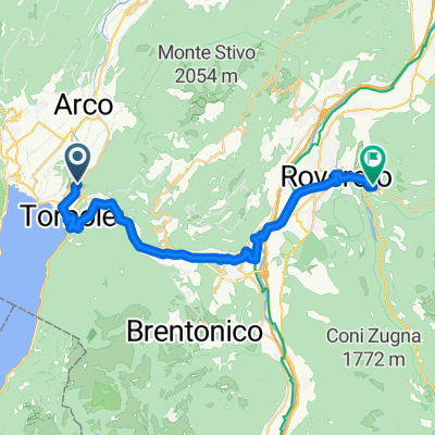
Torbole 62
A cycling route starting in Nago–Torbole, Trentino-Alto Adige, Italy.
Overview
About this route
ÄŚĂm vĂce zde napĂšete informacĂ, tĂm vĂce bude uĹľiteÄŤnÄ›jšà pro ostatnĂm uĹľivatele.<br /><br />* PrĹŻbÄ›h trasy.<br />* Co je zvláštnĂ na tĂ©to trase?<br />* ProÄŤ doporuÄŤit tuto trasu?<br />* Co se Vám zde nejvĂce lĂbilo?<br />* Atd.
- -:--
- Duration
- 61.6 km
- Distance
- 2,090 m
- Ascent
- 2,090 m
- Descent
- ---
- Avg. speed
- ---
- Max. altitude
Route quality
Waytypes & surfaces along the route
Waytypes
Busy road
28.3 km
(46 %)
Road
18.9 km
(31 %)
Surfaces
Paved
59.4 km
(96 %)
Unpaved
1.1 km
(2 %)
Asphalt
59.4 km
(96 %)
Ground
0.9 km
(1 %)
Continue with Bikemap
Use, edit, or download this cycling route
You would like to ride Torbole 62 or customize it for your own trip? Here is what you can do with this Bikemap route:
Free features
- Save this route as favorite or in collections
- Copy & plan your own version of this route
- Sync your route with Garmin or Wahoo
Premium features
Free trial for 3 days, or one-time payment. More about Bikemap Premium.
- Navigate this route on iOS & Android
- Export a GPX / KML file of this route
- Create your custom printout (try it for free)
- Download this route for offline navigation
Discover more Premium features.
Get Bikemap PremiumFrom our community
Other popular routes starting in Nago–Torbole
- Tour de Lago di Garda (from Nago)
- Distance
- 164.6 km
- Ascent
- 911 m
- Descent
- 911 m
- Location
- Nago–Torbole, Trentino-Alto Adige, Italy
- Nago bis Ceniga
- Distance
- 22.6 km
- Ascent
- 173 m
- Descent
- 173 m
- Location
- Nago–Torbole, Trentino-Alto Adige, Italy
- Nago - Monte Altissimo - Nago
- Distance
- 76.1 km
- Ascent
- 1,868 m
- Descent
- 1,869 m
- Location
- Nago–Torbole, Trentino-Alto Adige, Italy
- Garda - 1 - 95km - 2230hm
- Distance
- 102.4 km
- Ascent
- 2,323 m
- Descent
- 2,324 m
- Location
- Nago–Torbole, Trentino-Alto Adige, Italy
- rifugio altissimo
- Distance
- 51.8 km
- Ascent
- 1,968 m
- Descent
- 1,960 m
- Location
- Nago–Torbole, Trentino-Alto Adige, Italy
- Monte Altissimo
- Distance
- 14.7 km
- Ascent
- 1,280 m
- Descent
- 129 m
- Location
- Nago–Torbole, Trentino-Alto Adige, Italy
- 3K kolesarski izlet v okolici Gardsekga jezera 2011 - 5.6.
- Distance
- 81.1 km
- Ascent
- 1,668 m
- Descent
- 1,669 m
- Location
- Nago–Torbole, Trentino-Alto Adige, Italy
- 70km 1340hm
- Distance
- 70.3 km
- Ascent
- 1,312 m
- Descent
- 1,312 m
- Location
- Nago–Torbole, Trentino-Alto Adige, Italy
Open it in the app