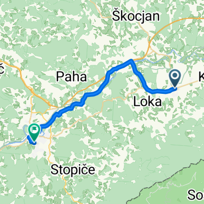
Jakobova pot D
- 30.1 km
- 459 m
- 454 m
- Šentjernej, Občina Šentjernej, Slovenia
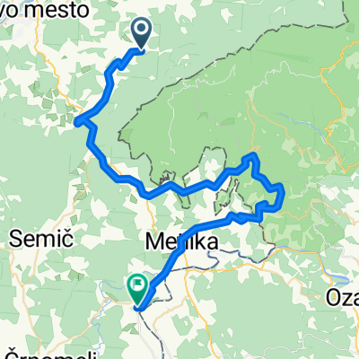
Cycling race Po Slovenia 2009 route of the 4th stage, Sunday, June 21, 2009 Start in Šentjerneju (Trubarjeva cesta) Finish in Novo mesto (Glavni trg), 153 km
Quiet road
70.8 km46 %Road
18.5 km12 %Paved
109.3 km(71 %)Unpaved
1.5 km(1 %)Asphalt
109.3 km71 %Unpaved (undefined)
1.5 km1 %Undefined
43.1 km28 %Šentjernej (185m), 25 km, leteči cilj
Gabrje (440 m), 69 km, Gorski cilj III. kategorije
Free trial for 3 days, or one-time payment. More about Bikemap Premium.
Discover more Premium features.
Get Bikemap PremiumOpen it in the app