

Rheinebene Heidelberg-Ladenburg-Speyer-Nußloch
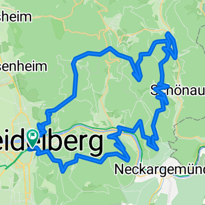
A cycling route starting in Heidelberg, Baden-Württemberg, Germany.
Overview
About this route
Zwischen Rheinau und Rohrhof die Unterführung (rechts halten) benutzen, nicht die Schnellstraße.
Bei der Einfahrt in Brühl nicht die markierte Radspur benutzen sondern rechts abbiegen.
In Speyer bietet sich eine Pause an, z.B.ein Eis am Dom oder beim Kiosk (man fährt dran vorbei). Nach dem Kiosk straßenseite Wechseln und die Fahrrad-Auffahrt zur Rheinbrücke benutzen.
Nach der Rheinbrücke noch auf der Brücken rechts runter, nach Altlußheim.
- -:--
- Duration
- 74.6 km
- Distance
- 118 m
- Ascent
- 126 m
- Descent
- ---
- Avg. speed
- 122 m
- Avg. speed

Route quality
Waytypes & surfaces along the route
Waytypes
Path
19.5 km
(26 %)
Busy road
18.7 km
(25 %)
Surfaces
Paved
70.6 km
(95 %)
Unpaved
1.2 km
(2 %)
Asphalt
64.5 km
(86 %)
Paving stones
5.4 km
(7 %)
Continue with Bikemap
Use, edit, or download this cycling route
You would like to ride Rheinebene Heidelberg-Ladenburg-Speyer-Nußloch or customize it for your own trip? Here is what you can do with this Bikemap route:
Free features
- Save this route as favorite or in collections
- Copy & plan your own version of this route
- Sync your route with Garmin or Wahoo
Premium features
Free trial for 3 days, or one-time payment. More about Bikemap Premium.
- Navigate this route on iOS & Android
- Export a GPX / KML file of this route
- Create your custom printout (try it for free)
- Download this route for offline navigation
Discover more Premium features.
Get Bikemap PremiumFrom our community
Other popular routes starting in Heidelberg
 Spielzeugrunde
- Distance
- 49.8 km
- Ascent
- 1,405 m
- Descent
- 1,403 m
- Location
- Heidelberg, Baden-Württemberg, Germany
 Around Heilingenberg
- Distance
- 22.7 km
- Ascent
- 618 m
- Descent
- 658 m
- Location
- Heidelberg, Baden-Württemberg, Germany
 HD->Königstuhl-Neckargemünd->Weisser Stein->HD
- Distance
- 50.5 km
- Ascent
- 1,166 m
- Descent
- 1,204 m
- Location
- Heidelberg, Baden-Württemberg, Germany
 Heidelbergman
- Distance
- 18.6 km
- Ascent
- 441 m
- Descent
- 548 m
- Location
- Heidelberg, Baden-Württemberg, Germany
 Von Heidelberg bis Karlsruhe
- Distance
- 67 km
- Ascent
- 634 m
- Descent
- 625 m
- Location
- Heidelberg, Baden-Württemberg, Germany
 HD-FrFld-MA
- Distance
- 19.3 km
- Ascent
- 11 m
- Descent
- 36 m
- Location
- Heidelberg, Baden-Württemberg, Germany
 Heidelberg kurz
- Distance
- 32.6 km
- Ascent
- 35 m
- Descent
- 36 m
- Location
- Heidelberg, Baden-Württemberg, Germany
 HD, Hirschhorn, Bammental, Königsstuhl
- Distance
- 62.1 km
- Ascent
- 974 m
- Descent
- 730 m
- Location
- Heidelberg, Baden-Württemberg, Germany
Open it in the app