

Durchs romantische Egertal
A cycling route starting in Marktredwitz, Bavaria, Germany.
Overview
About this route
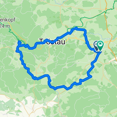
Beautiful bike tour through the romantic Egertal. Passing by Marktredwitz, Höchstädt, Kaiserhammer, Hendelhammer, Hohenberg, Arzberg and back to Marktredwitz.
Duration approx. 6 - 7 hours
- -:--
- Duration
- 56.4 km
- Distance
- 558 m
- Ascent
- 594 m
- Descent
- ---
- Avg. speed
- 626 m
- Max. altitude
Route quality
Waytypes & surfaces along the route
Waytypes
Track
19.7 km
(35 %)
Quiet road
19.2 km
(34 %)
Surfaces
Paved
19.7 km
(35 %)
Unpaved
20.9 km
(37 %)
Gravel
14.7 km
(26 %)
Asphalt
10.7 km
(19 %)
Continue with Bikemap
Use, edit, or download this cycling route
You would like to ride Durchs romantische Egertal or customize it for your own trip? Here is what you can do with this Bikemap route:
Free features
- Save this route as favorite or in collections
- Copy & plan your own version of this route
- Sync your route with Garmin or Wahoo
Premium features
Free trial for 3 days, or one-time payment. More about Bikemap Premium.
- Navigate this route on iOS & Android
- Export a GPX / KML file of this route
- Create your custom printout (try it for free)
- Download this route for offline navigation
Discover more Premium features.
Get Bikemap PremiumFrom our community
Other popular routes starting in Marktredwitz
 Markredwitz-Weiden1
- Distance
- 69.4 km
- Ascent
- 698 m
- Descent
- 837 m
- Location
- Marktredwitz, Bavaria, Germany
 hochstadt Bayreuth du 16 au 18
- Distance
- 54.8 km
- Ascent
- 654 m
- Descent
- 834 m
- Location
- Marktredwitz, Bavaria, Germany
 ADFC-Hof: Wochenendausfahrt "Maria Loreto"
- Distance
- 38.8 km
- Ascent
- 303 m
- Descent
- 327 m
- Location
- Marktredwitz, Bavaria, Germany
 Durchs romantische Egertal
- Distance
- 56.4 km
- Ascent
- 558 m
- Descent
- 594 m
- Location
- Marktredwitz, Bavaria, Germany
 ADFC Runde zum Fichtelsee
- Distance
- 59 km
- Ascent
- 622 m
- Descent
- 594 m
- Location
- Marktredwitz, Bavaria, Germany
 Zur Blockhütte ins Waldnaabtal
- Distance
- 64.9 km
- Ascent
- 461 m
- Descent
- 461 m
- Location
- Marktredwitz, Bavaria, Germany
 Marktredwitz - Waldsassen
- Distance
- 21.6 km
- Ascent
- 275 m
- Descent
- 326 m
- Location
- Marktredwitz, Bavaria, Germany
 Mitterteich-Friedenfels-Marktredwitz
- Distance
- 43.5 km
- Ascent
- 554 m
- Descent
- 562 m
- Location
- Marktredwitz, Bavaria, Germany
Open it in the app