

LA PIEDAD MICH. - CUERAMARO GTO. CLONED FROM ROUTE 410486
A cycling route starting in Santa Ana Pacueco, Guanajuato, Mexico.
Overview
About this route
- -:--
- Duration
- 70.6 km
- Distance
- 721 m
- Ascent
- 682 m
- Descent
- ---
- Avg. speed
- ---
- Max. altitude

Continue with Bikemap
Use, edit, or download this cycling route
You would like to ride LA PIEDAD MICH. - CUERAMARO GTO. CLONED FROM ROUTE 410486 or customize it for your own trip? Here is what you can do with this Bikemap route:
Free features
- Save this route as favorite or in collections
- Copy & plan your own version of this route
- Sync your route with Garmin or Wahoo
Premium features
Free trial for 3 days, or one-time payment. More about Bikemap Premium.
- Navigate this route on iOS & Android
- Export a GPX / KML file of this route
- Create your custom printout (try it for free)
- Download this route for offline navigation
Discover more Premium features.
Get Bikemap PremiumFrom our community
Other popular routes starting in Santa Ana Pacueco
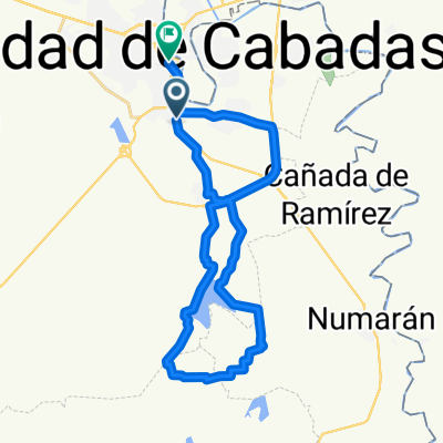
 LA PIEDAD MICH. - CUERAMARO GTO. CLONED FROM ROUTE 410486
- Distance
- 70.6 km
- Ascent
- 721 m
- Descent
- 682 m
- Location
- Santa Ana Pacueco, Guanajuato, Mexico
 sn jo
sn jo- Distance
- 56.9 km
- Ascent
- 589 m
- Descent
- 590 m
- Location
- Santa Ana Pacueco, Guanajuato, Mexico
 centro el triunfo la presa centro
- Distance
- 32.8 km
- Ascent
- 227 m
- Descent
- 227 m
- Location
- Santa Ana Pacueco, Guanajuato, Mexico
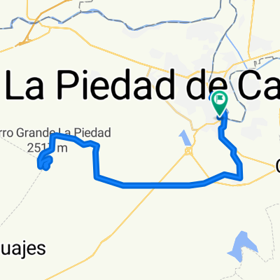 Reto Cerro Grande 2015
- Distance
- 49.7 km
- Ascent
- 886 m
- Descent
- 886 m
- Location
- Santa Ana Pacueco, Guanajuato, Mexico
 LA PIEDAD MICH. - CUERAMARO GTO. CLONED FROM ROUTE 410486
- Distance
- 70.6 km
- Ascent
- 742 m
- Descent
- 705 m
- Location
- Santa Ana Pacueco, Guanajuato, Mexico
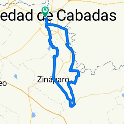 pejamillo
- Distance
- 73.5 km
- Ascent
- 390 m
- Descent
- 385 m
- Location
- Santa Ana Pacueco, Guanajuato, Mexico
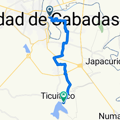 Relaxed route in La Piedad
- Distance
- 15.6 km
- Ascent
- 499 m
- Descent
- 298 m
- Location
- Santa Ana Pacueco, Guanajuato, Mexico
Open it in the app