

12 part 5/6 st. gertraud >>> refugio graffer
A cycling route starting in San Bernardo, Trentino-Alto Adige, Italy.
Overview
About this route
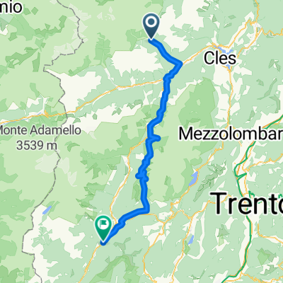
rabbijoch >>> auffahrt sehr leicht und sehr schön, hinter dem pass lecker essen in der hütte.
abfahrt ins sieht spektakulärer aus als sie tatsächlich ist, aber trotzdem viel spaß.
unten in malé vor dem anstieg noch nen café
bis zum passo campo carlo geht es sehr schön durch den wald, von dort zu ref. graffer entweder mit der seilbahn oder hochstrampeln, wenige und überschaubare steilstücke, ist schon ok. die brenta ist überwältigend keine frage, aber dort oben herrscht in weiten teilen abseits der wirtschaftwege ein mtb verbot, das wird auch konsequent verfolgt. also die frage ist lohnt der aufstieg für die spaßfreie abfahrt? ich finde nein.
übernachtung ref. graffer, solala
- -:--
- Duration
- 52.6 km
- Distance
- 2,549 m
- Ascent
- 1,713 m
- Descent
- ---
- Avg. speed
- ---
- Max. altitude

Continue with Bikemap
Use, edit, or download this cycling route
You would like to ride 12 part 5/6 st. gertraud >>> refugio graffer or customize it for your own trip? Here is what you can do with this Bikemap route:
Free features
- Save this route as favorite or in collections
- Copy & plan your own version of this route
- Sync your route with Garmin or Wahoo
Premium features
Free trial for 3 days, or one-time payment. More about Bikemap Premium.
- Navigate this route on iOS & Android
- Export a GPX / KML file of this route
- Create your custom printout (try it for free)
- Download this route for offline navigation
Discover more Premium features.
Get Bikemap PremiumFrom our community
Other popular routes starting in San Bernardo
 12 part 5/6 st. gertraud >>> refugio graffer
- Distance
- 52.6 km
- Ascent
- 2,549 m
- Descent
- 1,713 m
- Location
- San Bernardo, Trentino-Alto Adige, Italy
 2018 Tag 2-1
- Distance
- 77.3 km
- Ascent
- 1,915 m
- Descent
- 2,253 m
- Location
- San Bernardo, Trentino-Alto Adige, Italy
 ritorno migliore
- Distance
- 156.4 km
- Ascent
- 1,849 m
- Descent
- 2,276 m
- Location
- San Bernardo, Trentino-Alto Adige, Italy
 AlpenX2017_Etappe5
- Distance
- 49.5 km
- Ascent
- 1,887 m
- Descent
- 1,887 m
- Location
- San Bernardo, Trentino-Alto Adige, Italy
 Haselgruber Hütte - Rifugio Ghedina
- Distance
- 70.2 km
- Ascent
- 1,705 m
- Descent
- 3,017 m
- Location
- San Bernardo, Trentino-Alto Adige, Italy
 Tag 5.
- Distance
- 76.5 km
- Ascent
- 1,093 m
- Descent
- 1,517 m
- Location
- San Bernardo, Trentino-Alto Adige, Italy
 ALLE CASCATE DI VALORZ (VAL DE L’ORS)
- Distance
- 5.2 km
- Ascent
- 268 m
- Descent
- 268 m
- Location
- San Bernardo, Trentino-Alto Adige, Italy
 Transalp Etappe 6
- Distance
- 43.6 km
- Ascent
- 1,739 m
- Descent
- 1,728 m
- Location
- San Bernardo, Trentino-Alto Adige, Italy
Open it in the app