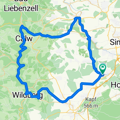
Ehningen Abendrunde
A cycling route starting in Ehningen, Baden-Württemberg, Germany.
Overview
About this route
Schoenbuch
- -:--
- Duration
- 25.5 km
- Distance
- 207 m
- Ascent
- 183 m
- Descent
- ---
- Avg. speed
- 561 m
- Avg. speed
Route quality
Waytypes & surfaces along the route
Waytypes
Track
14.8 km
(58 %)
Quiet road
4.7 km
(18 %)
Surfaces
Paved
10.3 km
(41 %)
Unpaved
13 km
(51 %)
Asphalt
10.3 km
(41 %)
Gravel
7 km
(27 %)
Continue with Bikemap
Use, edit, or download this cycling route
You would like to ride Ehningen Abendrunde or customize it for your own trip? Here is what you can do with this Bikemap route:
Free features
- Save this route as favorite or in collections
- Copy & plan your own version of this route
- Sync your route with Garmin or Wahoo
Premium features
Free trial for 3 days, or one-time payment. More about Bikemap Premium.
- Navigate this route on iOS & Android
- Export a GPX / KML file of this route
- Create your custom printout (try it for free)
- Download this route for offline navigation
Discover more Premium features.
Get Bikemap PremiumFrom our community
Other popular routes starting in Ehningen
- Dagersheim-Simozheim-Hirsau-Calw-Stammheim-Siebentannen-Deufringen-Aidlingen-Dagersheim
- Distance
- 50.1 km
- Ascent
- 635 m
- Descent
- 636 m
- Location
- Ehningen, Baden-Württemberg, Germany
- heimspiel Schönbuch
- Distance
- 35.7 km
- Ascent
- 235 m
- Descent
- 235 m
- Location
- Ehningen, Baden-Württemberg, Germany
- Naturpark Schönbuch
- Distance
- 42.3 km
- Ascent
- 217 m
- Descent
- 320 m
- Location
- Ehningen, Baden-Württemberg, Germany
- Würmtal-Nagoldtal Runde
- Distance
- 103.9 km
- Ascent
- 468 m
- Descent
- 468 m
- Location
- Ehningen, Baden-Württemberg, Germany
- Ehningen-Bondorf
- Distance
- 57.1 km
- Ascent
- 351 m
- Descent
- 351 m
- Location
- Ehningen, Baden-Württemberg, Germany
- Kleine Schönbuchrunde Goldersbachtal
- Distance
- 35.7 km
- Ascent
- 317 m
- Descent
- 317 m
- Location
- Ehningen, Baden-Württemberg, Germany
- Moderate route in Ehningen
- Distance
- 13.3 km
- Ascent
- 81 m
- Descent
- 80 m
- Location
- Ehningen, Baden-Württemberg, Germany
- Böblingen - Herrenberg - Deckenpfronn - Dachtel Rundkurs
- Distance
- 46 km
- Ascent
- 614 m
- Descent
- 603 m
- Location
- Ehningen, Baden-Württemberg, Germany