

Brennberg Sulzbach 01
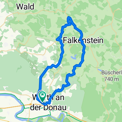
A cycling route starting in Wörth an der Donau, Bavaria, Germany.
Overview
About this route
Climb to Brennberg, then a short descent and again uphill to Bruckbach, a rapid descent to Fortsmühle and then an ascent near Scharr and a beautiful long descent to Sulzbach, back flat to Wörth
- -:--
- Duration
- 39.2 km
- Distance
- 492 m
- Ascent
- 507 m
- Descent
- ---
- Avg. speed
- ---
- Max. altitude

Route quality
Waytypes & surfaces along the route
Waytypes
Road
8.6 km
(22 %)
Quiet road
1.2 km
(3 %)
Surfaces
Paved
23.1 km
(59 %)
Asphalt
23.1 km
(59 %)
Undefined
16.1 km
(41 %)
Continue with Bikemap
Use, edit, or download this cycling route
You would like to ride Brennberg Sulzbach 01 or customize it for your own trip? Here is what you can do with this Bikemap route:
Free features
- Save this route as favorite or in collections
- Copy & plan your own version of this route
- Sync your route with Garmin or Wahoo
Premium features
Free trial for 3 days, or one-time payment. More about Bikemap Premium.
- Navigate this route on iOS & Android
- Export a GPX / KML file of this route
- Create your custom printout (try it for free)
- Download this route for offline navigation
Discover more Premium features.
Get Bikemap PremiumFrom our community
Other popular routes starting in Wörth an der Donau
 2010-Tag19: Wörthhof/Donau-Plattling
- Distance
- 63.8 km
- Ascent
- 76 m
- Descent
- 78 m
- Location
- Wörth an der Donau, Bavaria, Germany
 Donauauen auf Damm
- Distance
- 26.8 km
- Ascent
- 65 m
- Descent
- 53 m
- Location
- Wörth an der Donau, Bavaria, Germany
 Mietnacht
- Distance
- 44.4 km
- Ascent
- 579 m
- Descent
- 588 m
- Location
- Wörth an der Donau, Bavaria, Germany
 Thiergarten - Donau - Runde
- Distance
- 34.4 km
- Ascent
- 492 m
- Descent
- 490 m
- Location
- Wörth an der Donau, Bavaria, Germany
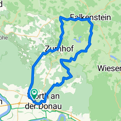 Gfäll - Falkenstein
- Distance
- 37.9 km
- Ascent
- 517 m
- Descent
- 510 m
- Location
- Wörth an der Donau, Bavaria, Germany
 Perlbach Perlbach Paradies Wörth an der Donau
- Distance
- 29 km
- Ascent
- 443 m
- Descent
- 443 m
- Location
- Wörth an der Donau, Bavaria, Germany
 2012 Wörth/Donau-Regensburg-Meihern/Altmühl
- Distance
- 97.5 km
- Ascent
- 107 m
- Descent
- 73 m
- Location
- Wörth an der Donau, Bavaria, Germany
 Wellerbach - Perlbach über Aumbach
- Distance
- 21.9 km
- Ascent
- 390 m
- Descent
- 391 m
- Location
- Wörth an der Donau, Bavaria, Germany
Open it in the app