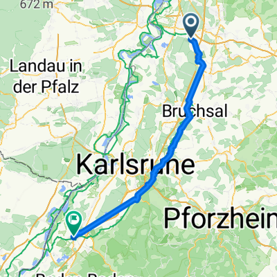
Kleine Kraichgaurunde
- 50.8 km
- 302 m
- 290 m
- Reilingen, Baden-Wurttemberg, Germany
A cycling route starting in Reilingen, Baden-Wurttemberg, Germany.
Overview
Hockenheim - Eichtersheim - Hockenheim
Almost exclusively on fields and bike paths. Along the way, you can also partially follow the bike path signs.
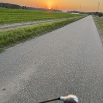
Very scenic.
created this 17 years ago
Route quality
Track
16.8 km
(33 %)
Quiet road
9.7 km
(19 %)
Paved
45.3 km
(89 %)
Unpaved
1.5 km
(3 %)
Asphalt
41.7 km
(82 %)
Paved (undefined)
2 km
(4 %)
Continue with Bikemap
You would like to ride Kleine Kraichgaurunde or customize it for your own trip? Here is what you can do with this Bikemap route:
Free trial for 3 days, or one-time payment. More about Bikemap Premium.
Discover more Premium features.
Get Bikemap PremiumFrom our community
Open it in the app