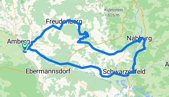
Johannisberg, Nabburg, Schwarzenfeld
A cycling route starting in Kümmersbruck, Bavaria, Germany.
Overview
About this route
A slightly longer ride with an initially good climb at Johannisberg. The rest of the ride was done at a higher pace. Partly a longer stretch on asphalt.
- -:--
- Duration
- 73.3 km
- Distance
- 640 m
- Ascent
- 640 m
- Descent
- ---
- Avg. speed
- ---
- Max. altitude
Route quality
Waytypes & surfaces along the route
Waytypes
Quiet road
19.8 km
(27 %)
Track
18.3 km
(25 %)
Surfaces
Paved
35.2 km
(48 %)
Unpaved
15.4 km
(21 %)
Asphalt
35.2 km
(48 %)
Gravel
10.3 km
(14 %)
Continue with Bikemap
Use, edit, or download this cycling route
You would like to ride Johannisberg, Nabburg, Schwarzenfeld or customize it for your own trip? Here is what you can do with this Bikemap route:
Free features
- Save this route as favorite or in collections
- Copy & plan your own version of this route
- Sync your route with Garmin or Wahoo
Premium features
Free trial for 3 days, or one-time payment. More about Bikemap Premium.
- Navigate this route on iOS & Android
- Export a GPX / KML file of this route
- Create your custom printout (try it for free)
- Download this route for offline navigation
Discover more Premium features.
Get Bikemap PremiumFrom our community
Other popular routes starting in Kümmersbruck
- Johannisberg, Nabburg, Schwarzenfeld
- Distance
- 73.3 km
- Ascent
- 640 m
- Descent
- 640 m
- Location
- Kümmersbruck, Bavaria, Germany
- längere Trainingsrunde
- Distance
- 73.8 km
- Ascent
- 784 m
- Descent
- 667 m
- Location
- Kümmersbruck, Bavaria, Germany
- Vilstalalternative Theuern - Ensdorf
- Distance
- 12.8 km
- Ascent
- 217 m
- Descent
- 215 m
- Location
- Kümmersbruck, Bavaria, Germany
- Kurze Radrunde Theuern
- Distance
- 10 km
- Ascent
- 50 m
- Descent
- 51 m
- Location
- Kümmersbruck, Bavaria, Germany
- Moos - Vilshofen - Haselbach
- Distance
- 58.3 km
- Ascent
- 465 m
- Descent
- 467 m
- Location
- Kümmersbruck, Bavaria, Germany
- Hirschwald
- Distance
- 32.5 km
- Ascent
- 279 m
- Descent
- 279 m
- Location
- Kümmersbruck, Bavaria, Germany
- Kümmersbruck_01
- Distance
- 8.4 km
- Ascent
- 71 m
- Descent
- 70 m
- Location
- Kümmersbruck, Bavaria, Germany
- Lintacher Steig, Johannisberg Marterlweg, Scharlmühle
- Distance
- 53.3 km
- Ascent
- 689 m
- Descent
- 689 m
- Location
- Kümmersbruck, Bavaria, Germany
Open it in the app