

Venaderos - Los Caños - Venaderos
A cycling route starting in Los Caños, Aguascalientes, Mexico.
Overview
About this route
Route completed on Saturday, April 6, 2013. Highly recommended for getting started with MTB.
- -:--
- Duration
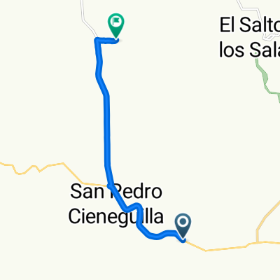
- 28.6 km
- Distance
- 286 m
- Ascent
- 286 m
- Descent
- ---
- Avg. speed
- ---
- Max. altitude

Continue with Bikemap
Use, edit, or download this cycling route
You would like to ride Venaderos - Los Caños - Venaderos or customize it for your own trip? Here is what you can do with this Bikemap route:
Free features
- Save this route as favorite or in collections
- Copy & plan your own version of this route
- Sync your route with Garmin or Wahoo
Premium features
Free trial for 3 days, or one-time payment. More about Bikemap Premium.
- Navigate this route on iOS & Android
- Export a GPX / KML file of this route
- Create your custom printout (try it for free)
- Download this route for offline navigation
Discover more Premium features.
Get Bikemap PremiumFrom our community
Other popular routes starting in Los Caños
 puentes cuates
- Distance
- 45.5 km
- Ascent
- 522 m
- Descent
- 622 m
- Location
- Los Caños, Aguascalientes, Mexico
 Ruta a Vía Sin Nombre
- Distance
- 8.2 km
- Ascent
- 128 m
- Descent
- 127 m
- Location
- Los Caños, Aguascalientes, Mexico
 el sabinal
- Distance
- 15.8 km
- Ascent
- 198 m
- Descent
- 109 m
- Location
- Los Caños, Aguascalientes, Mexico
 Malpaso Dam
- Distance
- 44.1 km
- Ascent
- 643 m
- Descent
- 643 m
- Location
- Los Caños, Aguascalientes, Mexico
 el ocote
- Distance
- 2.9 km
- Ascent
- 290 m
- Descent
- 83 m
- Location
- Los Caños, Aguascalientes, Mexico
 El ocote, la primera vez
- Distance
- 27.5 km
- Ascent
- 360 m
- Descent
- 360 m
- Location
- Los Caños, Aguascalientes, Mexico
 Venaderos - Los Caños - Venaderos
- Distance
- 28.6 km
- Ascent
- 286 m
- Descent
- 286 m
- Location
- Los Caños, Aguascalientes, Mexico
 Tapias viejas- Las Brisas
- Distance
- 21 km
- Ascent
- 84 m
- Descent
- 232 m
- Location
- Los Caños, Aguascalientes, Mexico
Open it in the app