

Wetterkreuz Tour
A cycling route starting in Saalbach, Salzburg, Austria.
Overview
About this route
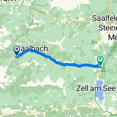
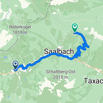
The Wetterkreuz Tour is a true dream ride in Saalbach Hinterglemm. The route first follows the Glemmtal Valley bike path from Hinterglemm to Saalbach, then heads towards Spielberghaus. This spot invites a stop, but just before it, you take a turnoff and follow a forest road towards Bernkogel. From the middle station, a new forest road leads to the Wetterkreuz, and from there, a mellow single trail goes to Reiteralm. From there, you can either take the road back to Hinterglemm or venture onto the freeride trails Blue or Pro Line.
- -:--
- Duration
- 20.4 km
- Distance
- 891 m
- Ascent
- 891 m
- Descent
- ---
- Avg. speed
- ---
- Max. altitude

Continue with Bikemap
Use, edit, or download this cycling route
You would like to ride Wetterkreuz Tour or customize it for your own trip? Here is what you can do with this Bikemap route:
Free features
- Save this route as favorite or in collections
- Copy & plan your own version of this route
- Sync your route with Garmin or Wahoo
Premium features
Free trial for 3 days, or one-time payment. More about Bikemap Premium.
- Navigate this route on iOS & Android
- Export a GPX / KML file of this route
- Create your custom printout (try it for free)
- Download this route for offline navigation
Discover more Premium features.
Get Bikemap PremiumFrom our community
Other popular routes starting in Saalbach
 Gravel Austria, Etappe Salzburg
- Distance
- 257.6 km
- Ascent
- 5,510 m
- Descent
- 6,342 m
- Location
- Saalbach, Salzburg, Austria
 Saalbach-Hinterglemm part 2
- Distance
- 19.9 km
- Ascent
- 640 m
- Descent
- 918 m
- Location
- Saalbach, Salzburg, Austria
 Route zu Panorama Alm
- Distance
- 13.2 km
- Ascent
- 830 m
- Descent
- 294 m
- Location
- Saalbach, Salzburg, Austria
 Z-Line in Saalbach Hinterglemm
- Distance
- 2.5 km
- Ascent
- 34 m
- Descent
- 496 m
- Location
- Saalbach, Salzburg, Austria
 The Big 5 Challenge Gondel Tour
- Distance
- 59.4 km
- Ascent
- 4,082 m
- Descent
- 4,080 m
- Location
- Saalbach, Salzburg, Austria
 Z-Line in Saalbach Hinterglemm
- Distance
- 2.5 km
- Ascent
- 34 m
- Descent
- 496 m
- Location
- Saalbach, Salzburg, Austria
 Saalbach 2009 - Hinterglem, Reiterkogel, Burgeralm
- Distance
- 36.6 km
- Ascent
- 1,403 m
- Descent
- 1,403 m
- Location
- Saalbach, Salzburg, Austria
 Saalbach 2009 - Jausern, Schattberg
- Distance
- 37.3 km
- Ascent
- 1,409 m
- Descent
- 1,388 m
- Location
- Saalbach, Salzburg, Austria
Open it in the app