

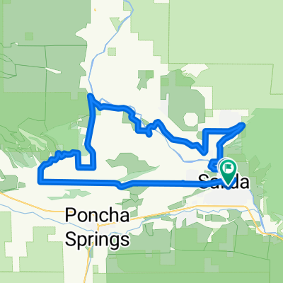
Salida CR 251, CR 250
A cycling route starting in Salida, Colorado, United States.
Overview
About this route
One of my favorite Colorado Jeep trail bike rides. In this counter-clockwise route, it's a good option when winds are high out of the West, by using the Arkansas river valley and tree / ravine wind protection on the 2,200 foot ascent. Airport road, going uphill in the clockwise direction, can be a tough haul with the full force of the westerly wind 'in your face'.
- -:--
- Duration
- 39.4 km
- Distance
- 647 m
- Ascent
- 643 m
- Descent
- ---
- Avg. speed
- ---
- Max. altitude

Continue with Bikemap
Use, edit, or download this cycling route
You would like to ride Salida CR 251, CR 250 or customize it for your own trip? Here is what you can do with this Bikemap route:
Free features
- Save this route as favorite or in collections
- Copy & plan your own version of this route
- Sync your route with Garmin or Wahoo
Premium features
Free trial for 3 days, or one-time payment. More about Bikemap Premium.
- Navigate this route on iOS & Android
- Export a GPX / KML file of this route
- Create your custom printout (try it for free)
- Download this route for offline navigation
Discover more Premium features.
Get Bikemap PremiumFrom our community
Other popular routes starting in Salida
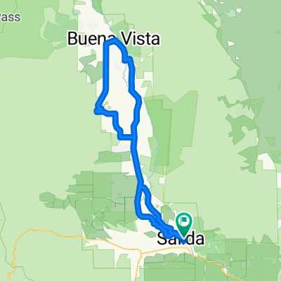 Salida - Princeton Hot Springs - Buena Vista - Salida
- Distance
- 91.2 km
- Ascent
- 582 m
- Descent
- 582 m
- Location
- Salida, Colorado, United States
 Saturday
- Distance
- 37.2 km
- Ascent
- 404 m
- Descent
- 404 m
- Location
- Salida, Colorado, United States
 05CO_Salida-Pueblo
- Distance
- 160.8 km
- Ascent
- 374 m
- Descent
- 1,057 m
- Location
- Salida, Colorado, United States
 Ute Trail Pass
- Distance
- 20.1 km
- Ascent
- 896 m
- Descent
- 37 m
- Location
- Salida, Colorado, United States
 Salida CR 250 Dirt Ride
- Distance
- 39 km
- Ascent
- 600 m
- Descent
- 601 m
- Location
- Salida, Colorado, United States
 Salida - Crestone - Salida
- Distance
- 183.9 km
- Ascent
- 1,087 m
- Descent
- 1,083 m
- Location
- Salida, Colorado, United States
 Salida CR 251, CR 250
- Distance
- 39.4 km
- Ascent
- 647 m
- Descent
- 643 m
- Location
- Salida, Colorado, United States
 Salida - Chalk Cliffs - Buena Vista - Salida
- Distance
- 41.9 km
- Ascent
- 621 m
- Descent
- 263 m
- Location
- Salida, Colorado, United States
Open it in the app