

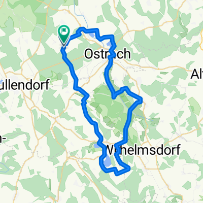
Rundtour Levertsweiler-Sigmaringen u. zurück
A cycling route starting in Ostrach, Baden-Württemberg, Germany.
Overview
About this route
90 % Asphaltweg sehr flach. Für Anfänger sehr gut geeignet. Viele Einkehrmöglichkeiten. Streck für Treckingbike bestens geeignet! Viel Spaß -Georg-
- -:--
- Duration
- 50.4 km
- Distance
- 215 m
- Ascent
- 210 m
- Descent
- ---
- Avg. speed
- ---
- Max. altitude
Route quality
Waytypes & surfaces along the route
Waytypes
Quiet road
21.7 km
(43 %)
Track
14.4 km
(29 %)
Surfaces
Paved
37.1 km
(74 %)
Unpaved
6.7 km
(13 %)
Asphalt
35.4 km
(70 %)
Loose gravel
3.7 km
(7 %)
Continue with Bikemap
Use, edit, or download this cycling route
You would like to ride Rundtour Levertsweiler-Sigmaringen u. zurück or customize it for your own trip? Here is what you can do with this Bikemap route:
Free features
- Save this route as favorite or in collections
- Copy & plan your own version of this route
- Sync your route with Garmin or Wahoo
Premium features
Free trial for 3 days, or one-time payment. More about Bikemap Premium.
- Navigate this route on iOS & Android
- Export a GPX / KML file of this route
- Create your custom printout (try it for free)
- Download this route for offline navigation
Discover more Premium features.
Get Bikemap PremiumFrom our community
Other popular routes starting in Ostrach
 Illmensee
- Distance
- 46.5 km
- Ascent
- 563 m
- Descent
- 564 m
- Location
- Ostrach, Baden-Württemberg, Germany
 Über den Höchsten und den Judentenberg
- Distance
- 56.5 km
- Ascent
- 607 m
- Descent
- 610 m
- Location
- Ostrach, Baden-Württemberg, Germany
 Ostrach-Sigmaringen-Alb-Bärenhöhle-Laucherttal-Ostrach
- Distance
- 131 km
- Ascent
- 811 m
- Descent
- 811 m
- Location
- Ostrach, Baden-Württemberg, Germany
 Pfrungener Ried
- Distance
- 28.3 km
- Ascent
- 156 m
- Descent
- 162 m
- Location
- Ostrach, Baden-Württemberg, Germany
 Ostrach-Donautal-Ablachtal-Ostrach
- Distance
- 70 km
- Ascent
- 798 m
- Descent
- 787 m
- Location
- Ostrach, Baden-Württemberg, Germany
 Fb-Erba-2
- Distance
- 153.2 km
- Ascent
- 942 m
- Descent
- 1,057 m
- Location
- Ostrach, Baden-Württemberg, Germany
 Radfahrverein Rosna Wanderradfahren am 21.07.2013
- Distance
- 43.2 km
- Ascent
- 253 m
- Descent
- 253 m
- Location
- Ostrach, Baden-Württemberg, Germany
 Rundtour Levertsweiler-Sigmaringen u. zurück
- Distance
- 50.4 km
- Ascent
- 215 m
- Descent
- 210 m
- Location
- Ostrach, Baden-Württemberg, Germany
Open it in the app