

Bandol 70km
A cycling route starting in Bandol, Provence-Alpes-Côte d'Azur Region, France.
Overview
About this route
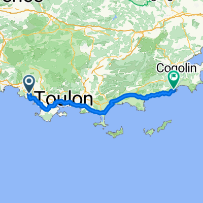
Bandol, the plan of Castellet, the roundabout of Cadière, the Brùlat, the valley of silence, ascent of the circuit (direction Signes), the lap of the circuit, the camp of Castellet, the grand Caunet, Ceyreste, La Ciotat town, La Ciotat St Jean, the seaside, the Lecques, the Madrague, port d'Alon, the hot oven, Bandol
- -:--
- Duration
- 69.7 km
- Distance
- 713 m
- Ascent
- 704 m
- Descent
- ---
- Avg. speed
- ---
- Max. altitude
Route quality
Waytypes & surfaces along the route
Waytypes
Road
9.1 km
(13 %)
Quiet road
8.4 km
(12 %)
Surfaces
Paved
39 km
(56 %)
Asphalt
38.3 km
(55 %)
Concrete
0.7 km
(1 %)
Undefined
30.7 km
(44 %)
Continue with Bikemap
Use, edit, or download this cycling route
You would like to ride Bandol 70km or customize it for your own trip? Here is what you can do with this Bikemap route:
Free features
- Save this route as favorite or in collections
- Copy & plan your own version of this route
- Sync your route with Garmin or Wahoo
Premium features
Free trial for 3 days, or one-time payment. More about Bikemap Premium.
- Navigate this route on iOS & Android
- Export a GPX / KML file of this route
- Create your custom printout (try it for free)
- Download this route for offline navigation
Discover more Premium features.
Get Bikemap PremiumFrom our community
Other popular routes starting in Bandol
 Facile à conduire Bandol
- Distance
- 9.3 km
- Ascent
- 173 m
- Descent
- 303 m
- Location
- Bandol, Provence-Alpes-Côte d'Azur Region, France
 Bandol - Le Castellet
- Distance
- 27.8 km
- Ascent
- 434 m
- Descent
- 441 m
- Location
- Bandol, Provence-Alpes-Côte d'Azur Region, France
 sommet du gros cerveau
- Distance
- 16.1 km
- Ascent
- 444 m
- Descent
- 84 m
- Location
- Bandol, Provence-Alpes-Côte d'Azur Region, France
 XPT 14J Bandol - Cavalaire
- Distance
- 86.7 km
- Ascent
- 293 m
- Descent
- 399 m
- Location
- Bandol, Provence-Alpes-Côte d'Azur Region, France
 Bandol 63km
- Distance
- 63.4 km
- Ascent
- 734 m
- Descent
- 736 m
- Location
- Bandol, Provence-Alpes-Côte d'Azur Region, France
 Bandol 70km
- Distance
- 69.7 km
- Ascent
- 713 m
- Descent
- 704 m
- Location
- Bandol, Provence-Alpes-Côte d'Azur Region, France
 le beausset
- Distance
- 14.6 km
- Ascent
- 336 m
- Descent
- 233 m
- Location
- Bandol, Provence-Alpes-Côte d'Azur Region, France
 Gros Cerveau et Roustagnon
- Distance
- 14.8 km
- Ascent
- 595 m
- Descent
- 554 m
- Location
- Bandol, Provence-Alpes-Côte d'Azur Region, France
Open it in the app