

Bítovánky - Lukov
A cycling route starting in Želetava, Kraj Vysočina, Czechia.
Overview
About this route
Čím více zde napíšete informací, tím více bude užitečnější pro ostatním uživatele.* Průběh trasy.* Co je zvláštní na této trase?* Proč doporučit tuto trasu?* Co se Vám zde nejvíce líbilo?* Atd.
- -:--
- Duration
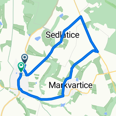
- 23.4 km
- Distance
- 165 m
- Ascent
- 290 m
- Descent
- ---
- Avg. speed
- ---
- Max. altitude

Route quality
Waytypes & surfaces along the route
Waytypes
Road
16.8 km
(72 %)
Quiet road
1.4 km
(6 %)
Continue with Bikemap
Use, edit, or download this cycling route
You would like to ride Bítovánky - Lukov or customize it for your own trip? Here is what you can do with this Bikemap route:
Free features
- Save this route as favorite or in collections
- Copy & plan your own version of this route
- Sync your route with Garmin or Wahoo
Premium features
Free trial for 3 days, or one-time payment. More about Bikemap Premium.
- Navigate this route on iOS & Android
- Export a GPX / KML file of this route
- Create your custom printout (try it for free)
- Download this route for offline navigation
Discover more Premium features.
Get Bikemap PremiumFrom our community
Other popular routes starting in Želetava
 Předín 242, Předín nach náměstí Míru 146, Želetava
- Distance
- 6.5 km
- Ascent
- 1,824 m
- Descent
- 1,888 m
- Location
- Želetava, Kraj Vysočina, Czechia
 Na kole dětem - z Želetavy
- Distance
- 77.9 km
- Ascent
- 438 m
- Descent
- 440 m
- Location
- Želetava, Kraj Vysočina, Czechia
 směska Telč
- Distance
- 71.1 km
- Ascent
- 732 m
- Descent
- 733 m
- Location
- Želetava, Kraj Vysočina, Czechia
 zkouska
- Distance
- 8.3 km
- Ascent
- 82 m
- Descent
- 101 m
- Location
- Želetava, Kraj Vysočina, Czechia
 Okolice Telcza i Jemnic
- Distance
- 265.7 km
- Ascent
- 1,115 m
- Descent
- 1,115 m
- Location
- Želetava, Kraj Vysočina, Czechia
 Zeletava - Vienne (e2 Giro)
- Distance
- 143.9 km
- Ascent
- 423 m
- Descent
- 822 m
- Location
- Želetava, Kraj Vysočina, Czechia
 Silnice 38, Želetava nach Vranov nad Dyjí 436, Vranov nad Dyjí
- Distance
- 41 km
- Ascent
- 268 m
- Descent
- 491 m
- Location
- Želetava, Kraj Vysočina, Czechia
 Bítovánky - Lukov
- Distance
- 23.4 km
- Ascent
- 165 m
- Descent
- 290 m
- Location
- Želetava, Kraj Vysočina, Czechia
Open it in the app