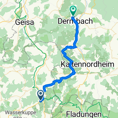
- 69.3 km
- 359 m
- 568 m
- Hilders, Hesse, Germany
(Fulda - Milseburgradweg) - Seiferts - Hendungen
A cycling route starting in Hilders, Hesse, Germany.
Overview
About this route
On June 6th, with heavy rain, headwind, and cool 6° in the Hochrhön... terribly frozen during the descent from Schwarzes Moor!
1st part: http://www.bikemap.net/route/195247 4 km and 50 hm
2nd part: http://www.bikemap.net/route/4405 27 km and 400 hm
this is the 3rd part: http://www.bikemap.net/route/206523 43 km and 500 hm
all together 74 km and 950 hm.
- -:--
- Duration
- 43.3 km
- Distance
- 518 m
- Ascent
- 655 m
- Descent
- ---
- Avg. speed
- 801 m
- Max. altitude
created this 16 years ago
Route quality
Waytypes & surfaces along the route
Waytypes
Track
6.5 km
(15 %)
Quiet road
4.3 km
(10 %)
Surfaces
Paved
36 km
(83 %)
Unpaved
3.5 km
(8 %)
Asphalt
36 km
(83 %)
Ground
1.7 km
(4 %)
Continue with Bikemap
Use, edit, or download this cycling route
You would like to ride (Fulda - Milseburgradweg) - Seiferts - Hendungen or customize it for your own trip? Here is what you can do with this Bikemap route:
Free features
- Save this route as favorite or in collections
- Copy & plan your own version of this route
- Sync your route with Garmin or Wahoo
Premium features
Free trial for 3 days, or one-time payment. More about Bikemap Premium.
- Navigate this route on iOS & Android
- Export a GPX / KML file of this route
- Create your custom printout (try it for free)
- Download this route for offline navigation
Discover more Premium features.
Get Bikemap PremiumFrom our community
Other popular routes starting in Hilders
- 2,Tag Hilders/Eckweisbach nach Vacha
- Batten Findlos Abzweig, Hilders nach Lindigstraße 66, Dermbach
- 32.4 km
- 529 m
- 672 m
- Hilders, Hesse, Germany
- Hilders Runde
- 41.4 km
- 978 m
- 957 m
- Hilders, Hesse, Germany
- Vorschlag Rhönrunde Samstag
- 43.9 km
- 646 m
- 646 m
- Hilders, Hesse, Germany
- Milseburgradweg
- 27 km
- 207 m
- 331 m
- Hilders, Hesse, Germany
- Mitte Deutschlandtour 8.Tag
- 46.3 km
- 384 m
- 586 m
- Hilders, Hesse, Germany
- Hilders Hochrhöntour loop
- 51 km
- 907 m
- 906 m
- Hilders, Hesse, Germany
- (Fulda - Milseburgradweg) - Seiferts - Hendungen
- 43.3 km
- 518 m
- 655 m
- Hilders, Hesse, Germany
Open it in the app


