

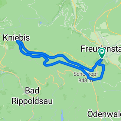
Sola aktuell Teil-2 Freudenstadt-Hardt
A cycling route starting in Freudenstadt, Baden-Wurttemberg, Germany.
Overview
About this route
längs durch den Schwarzwald viele Abschnitte auf Nebenstrassen und gut ausgebauten Radwegen
- -:--
- Duration
- 41.8 km
- Distance
- 610 m
- Ascent
- 553 m
- Descent
- ---
- Avg. speed
- ---
- Max. altitude
Route quality
Waytypes & surfaces along the route
Waytypes
Busy road
28.2 km
(67 %)
Path
6.6 km
(16 %)
Surfaces
Paved
30.5 km
(73 %)
Unpaved
0.1 km
(<1 %)
Asphalt
29.5 km
(71 %)
Paved (undefined)
0.9 km
(2 %)
Continue with Bikemap
Use, edit, or download this cycling route
You would like to ride Sola aktuell Teil-2 Freudenstadt-Hardt or customize it for your own trip? Here is what you can do with this Bikemap route:
Free features
- Save this route as favorite or in collections
- Copy & plan your own version of this route
- Sync your route with Garmin or Wahoo
Premium features
Free trial for 3 days, or one-time payment. More about Bikemap Premium.
- Navigate this route on iOS & Android
- Export a GPX / KML file of this route
- Create your custom printout (try it for free)
- Download this route for offline navigation
Discover more Premium features.
Get Bikemap PremiumFrom our community
Other popular routes starting in Freudenstadt
 Sankenbachsee
- Distance
- 19.6 km
- Ascent
- 433 m
- Descent
- 431 m
- Location
- Freudenstadt, Baden-Wurttemberg, Germany
 Ausfahrt durch Freudenstadt
- Distance
- 27.9 km
- Ascent
- 397 m
- Descent
- 398 m
- Location
- Freudenstadt, Baden-Wurttemberg, Germany
 Baiersbronn Tonbach Huzenbachseeblick Ruhestein Schliffkopf FDS
- Distance
- 64.6 km
- Ascent
- 833 m
- Descent
- 833 m
- Location
- Freudenstadt, Baden-Wurttemberg, Germany
 Schwarzwaldtour
- Distance
- 81.5 km
- Ascent
- 185 m
- Descent
- 692 m
- Location
- Freudenstadt, Baden-Wurttemberg, Germany
 Freudenstadt für die Mittagspause
- Distance
- 19.7 km
- Ascent
- 294 m
- Descent
- 294 m
- Location
- Freudenstadt, Baden-Wurttemberg, Germany
 Tour Schwarzwald - Kleines Kinzigtal
- Distance
- 41.6 km
- Ascent
- 674 m
- Descent
- 677 m
- Location
- Freudenstadt, Baden-Wurttemberg, Germany
 Über den Kniebis zum Sankenbach
- Distance
- 35.4 km
- Ascent
- 516 m
- Descent
- 586 m
- Location
- Freudenstadt, Baden-Wurttemberg, Germany
 Schwarzwald Panorama-Radweg Tag 2
- Distance
- 59.1 km
- Ascent
- 528 m
- Descent
- 495 m
- Location
- Freudenstadt, Baden-Wurttemberg, Germany
Open it in the app