

1-balade des 5 chaumes
A cycling route starting in Villé, Grand Est, France.
Overview
About this route
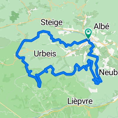
Very varied ride (35 km) with beautiful views of different horizons (Donon, Climont, Val de Villé), almost always between 800 and 1000 m, passing through 5 successive clearings: old farmstead, champ du feu, Haut-Lachamp, veal clearing, grande bellevue.
This route consists of 3 loops, you can limit to 20 km by doing only two.
Hotel-restaurant at the Col de la Charbonnière (2 passes), inn at the veal clearing, farm-inn at the Col du Kreuzweg
- -:--
- Duration
- 34.3 km
- Distance
- 773 m
- Ascent
- 773 m
- Descent
- ---
- Avg. speed
- ---
- Max. altitude
Route quality
Waytypes & surfaces along the route
Waytypes
Track
21.3 km
(62 %)
Path
3.8 km
(11 %)
Surfaces
Paved
3.8 km
(11 %)
Unpaved
13.7 km
(40 %)
Gravel
8.2 km
(24 %)
Asphalt
3.4 km
(10 %)
Route highlights
Points of interest along the route
Point of interest after 5.7 km
Chaume de la vieille métairie
Point of interest after 8.4 km
Chaume du champ du feu
Point of interest after 12.9 km
Col de la charbonnière
Point of interest after 16.3 km
Chaume du haut Lachamp
Point of interest after 25.2 km
Chaume des veaux
Point of interest after 29.7 km
Chaume de la grande bellevue
Continue with Bikemap
Use, edit, or download this cycling route
You would like to ride 1-balade des 5 chaumes or customize it for your own trip? Here is what you can do with this Bikemap route:
Free features
- Save this route as favorite or in collections
- Copy & plan your own version of this route
- Sync your route with Garmin or Wahoo
Premium features
Free trial for 3 days, or one-time payment. More about Bikemap Premium.
- Navigate this route on iOS & Android
- Export a GPX / KML file of this route
- Create your custom printout (try it for free)
- Download this route for offline navigation
Discover more Premium features.
Get Bikemap PremiumFrom our community
Other popular routes starting in Villé
 20190525_hwh-climont_38km_1190hm
- Distance
- 37.5 km
- Ascent
- 1,173 m
- Descent
- 1,162 m
- Location
- Villé, Grand Est, France
 20190525_hwh-ungersberg-hungerplatz-welschbruch-cdf-hwh_40km-1080hm
- Distance
- 40 km
- Ascent
- 1,042 m
- Descent
- 1,041 m
- Location
- Villé, Grand Est, France
 Neubois
- Distance
- 850.5 km
- Ascent
- 3,539 m
- Descent
- 3,772 m
- Location
- Villé, Grand Est, France
 TP 20160912 VAR2 VILLE
- Distance
- 49.1 km
- Ascent
- 1,501 m
- Descent
- 1,510 m
- Location
- Villé, Grand Est, France
 Hohwaldhütte Steinschloss
- Distance
- 19.6 km
- Ascent
- 600 m
- Descent
- 600 m
- Location
- Villé, Grand Est, France
 Steinschloss - Champ du feu 25.5.19
- Distance
- 33.8 km
- Ascent
- 576 m
- Descent
- 574 m
- Location
- Villé, Grand Est, France
 Tour Triembach über Col de Urbeis und Col de Steige
- Distance
- 34 km
- Ascent
- 678 m
- Descent
- 676 m
- Location
- Villé, Grand Est, France
 4_Le tour de Breit'
- Distance
- 11.8 km
- Ascent
- 421 m
- Descent
- 421 m
- Location
- Villé, Grand Est, France
Open it in the app