

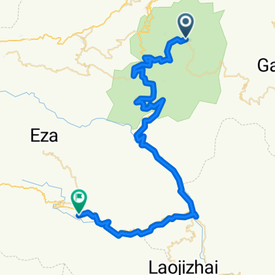
勝村鄉→壩達景區3k→大勝段元陽梯田景區9k→S214路邊老虎咀梯田景區19k→老勐鄉53k→黃草嶺鄉72k
A cycling route starting in Nansha, Yunnan, China.
Overview
About this route
勝村鄉→壩達景區3k→大勝段元陽梯田景區9k→S214路邊老虎咀梯田景區19k→老勐鄉有4間旅館53k→黃草嶺鄉有5間旅館72k
- -:--
- Duration
- 73.6 km
- Distance
- 1,736 m
- Ascent
- 2,785 m
- Descent
- ---
- Avg. speed
- ---
- Max. altitude
Continue with Bikemap
Use, edit, or download this cycling route
You would like to ride 勝村鄉→壩達景區3k→大勝段元陽梯田景區9k→S214路邊老虎咀梯田景區19k→老勐鄉53k→黃草嶺鄉72k or customize it for your own trip? Here is what you can do with this Bikemap route:
Free features
- Save this route as favorite or in collections
- Copy & plan your own version of this route
- Sync your route with Garmin or Wahoo
Premium features
Free trial for 3 days, or one-time payment. More about Bikemap Premium.
- Navigate this route on iOS & Android
- Export a GPX / KML file of this route
- Create your custom printout (try it for free)
- Download this route for offline navigation
Discover more Premium features.
Get Bikemap PremiumFrom our community
Other popular routes starting in Nansha
 yujtyjtyj
- Distance
- 161.1 km
- Ascent
- 677 m
- Descent
- 806 m
- Location
- Nansha, Yunnan, China
 907棚田ピストン
- Distance
- 38.3 km
- Ascent
- 2,080 m
- Descent
- 449 m
- Location
- Nansha, Yunnan, China
 雲南單車遊, Day 5, 元陽, 老勐
- Distance
- 82.1 km
- Ascent
- 2,646 m
- Descent
- 2,400 m
- Location
- Nansha, Yunnan, China
 2T10 Jianshui
- Distance
- 109.9 km
- Ascent
- 1,798 m
- Descent
- 2,058 m
- Location
- Nansha, Yunnan, China
 Duoyishu to Namsha - Feb 26
- Distance
- 59.2 km
- Ascent
- 127 m
- Descent
- 1,861 m
- Location
- Nansha, Yunnan, China
 zdfdh
zdfdh- Distance
- 215.2 km
- Ascent
- 974 m
- Descent
- 1,317 m
- Location
- Nansha, Yunnan, China
 2T08 Xinjie
- Distance
- 30.8 km
- Ascent
- 1,394 m
- Descent
- 77 m
- Location
- Nansha, Yunnan, China
 勝村鄉→壩達景區3k→大勝段元陽梯田景區9k→S214路邊老虎咀梯田景區19k→老勐鄉53k→黃草嶺鄉72k
- Distance
- 73.6 km
- Ascent
- 1,736 m
- Descent
- 2,785 m
- Location
- Nansha, Yunnan, China
Open it in the app