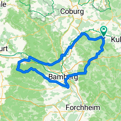
Große Steigerwald Runde
- 176.1 km
- 780 m
- 783 m
- Altenkunstadt, Bavaria, Germany
A cycling route starting in Altenkunstadt, Bavaria, Germany.
Overview
Classic through the Main valley - up into the Steigerwald and as the final ascent Tiefenellern
created this 12 years ago
Route quality
Road
44 km
(25 %)
Quiet road
17.6 km
(10 %)
Paved
123.2 km
(70 %)
Asphalt
121.5 km
(69 %)
Concrete
1.8 km
(1 %)
Undefined
52.8 km
(30 %)
Continue with Bikemap
You would like to ride Große Steigerwald Runde or customize it for your own trip? Here is what you can do with this Bikemap route:
Free trial for 3 days, or one-time payment. More about Bikemap Premium.
Discover more Premium features.
Get Bikemap PremiumFrom our community
Open it in the app