

Nyugati Papuk kör
A cycling route starting in Voćin, Virovitica-Podravina County, Croatia.
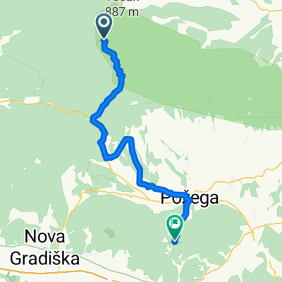
Overview
About this route
Tough but beautiful tour around the Papuk peak.
Gravel road between Slatinski Drenovac and Velika, as well as Poljanska and Kamnski Vucjak.
- -:--
- Duration
- 77.3 km
- Distance
- 1,198 m
- Ascent
- 1,198 m
- Descent
- ---
- Avg. speed
- ---
- Max. altitude

Route quality
Waytypes & surfaces along the route
Waytypes
Quiet road
16.2 km
(21 %)
Road
14.7 km
(19 %)
Surfaces
Paved
60.3 km
(78 %)
Unpaved
14.7 km
(19 %)
Asphalt
60.3 km
(78 %)
Gravel
14.7 km
(19 %)
Undefined
2.3 km
(3 %)
Continue with Bikemap
Use, edit, or download this cycling route
You would like to ride Nyugati Papuk kör or customize it for your own trip? Here is what you can do with this Bikemap route:
Free features
- Save this route as favorite or in collections
- Copy & plan your own version of this route
- Sync your route with Garmin or Wahoo
Premium features
Free trial for 3 days, or one-time payment. More about Bikemap Premium.
- Navigate this route on iOS & Android
- Export a GPX / KML file of this route
- Create your custom printout (try it for free)
- Download this route for offline navigation
Discover more Premium features.
Get Bikemap PremiumFrom our community
Other popular routes starting in Voćin
 BORački put
- Distance
- 9.9 km
- Ascent
- 444 m
- Descent
- 442 m
- Location
- Voćin, Virovitica-Podravina County, Croatia
 Atyinából a Pakra-völgyi monostorhoz
- Distance
- 46.3 km
- Ascent
- 886 m
- Descent
- 891 m
- Location
- Voćin, Virovitica-Podravina County, Croatia
 ZvecevoE
- Distance
- 59.4 km
- Ascent
- 1,192 m
- Descent
- 1,193 m
- Location
- Voćin, Virovitica-Podravina County, Croatia
 Brdima u blizini Voćina
- Distance
- 33.2 km
- Ascent
- 745 m
- Descent
- 745 m
- Location
- Voćin, Virovitica-Podravina County, Croatia
 Vocin - Papuk nyugati oldal
- Distance
- 60.1 km
- Ascent
- 999 m
- Descent
- 998 m
- Location
- Voćin, Virovitica-Podravina County, Croatia
 Nyugati Papuk kör
- Distance
- 77.3 km
- Ascent
- 1,198 m
- Descent
- 1,198 m
- Location
- Voćin, Virovitica-Podravina County, Croatia
 Voćin-Crni vrh-Voćin
- Distance
- 61.1 km
- Ascent
- 1,005 m
- Descent
- 1,005 m
- Location
- Voćin, Virovitica-Podravina County, Croatia
 D 8 Ruta Papuk
- Distance
- 56.5 km
- Ascent
- 327 m
- Descent
- 585 m
- Location
- Voćin, Virovitica-Podravina County, Croatia
Open it in the app