

marthod1
A cycling route starting in Albertville, Auvergne-Rhône-Alpes, France.
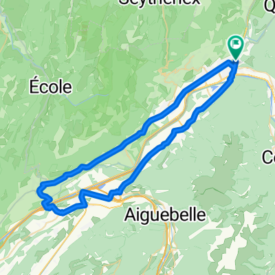
Overview
About this route
albertville-marthod-les rafforts
- vers alpettaz
- -:--
- Duration
- 17.9 km
- Distance
- 912 m
- Ascent
- 31 m
- Descent
- ---
- Avg. speed
- ---
- Max. altitude
Route quality
Waytypes & surfaces along the route
Waytypes
Road
9.1 km
(51 %)
Quiet road
4.3 km
(24 %)
Surfaces
Paved
14.9 km
(83 %)
Asphalt
14.9 km
(83 %)
Undefined
3 km
(17 %)
Route highlights
Points of interest along the route

Point of interest after 1.1 km
albertville depart 10h

Point of interest after 1.3 km
albertville

Point of interest after 1.9 km

Point of interest after 2.1 km
depart piste ugine

Point of interest after 3.6 km

Point of interest after 5.3 km

Point of interest after 8.2 km
marthod son marteau pilon hydraulique la forge

Point of interest after 9.5 km

Point of interest after 11.4 km

Point of interest after 12.4 km

Point of interest after 12.9 km

Point of interest after 13.7 km

Point of interest after 13.8 km

Point of interest after 14.3 km

Point of interest after 14.8 km

Point of interest after 14.9 km

Point of interest after 15.3 km

Point of interest after 16.7 km

Accommodation after 17.9 km
Continue with Bikemap
Use, edit, or download this cycling route
You would like to ride marthod1 or customize it for your own trip? Here is what you can do with this Bikemap route:
Free features
- Save this route as favorite or in collections
- Copy & plan your own version of this route
- Sync your route with Garmin or Wahoo
Premium features
Free trial for 3 days, or one-time payment. More about Bikemap Premium.
- Navigate this route on iOS & Android
- Export a GPX / KML file of this route
- Create your custom printout (try it for free)
- Download this route for offline navigation
Discover more Premium features.
Get Bikemap PremiumFrom our community
Other popular routes starting in Albertville
 albertville - colle delle finestre (italy)
- Distance
- 197.2 km
- Ascent
- 4,734 m
- Descent
- 3,088 m
- Location
- Albertville, Auvergne-Rhône-Alpes, France
 D'ALBERTVILLE A ANNECY 50KMS ENVIRON
- Distance
- 46.5 km
- Ascent
- 199 m
- Descent
- 86 m
- Location
- Albertville, Auvergne-Rhône-Alpes, France
 Beaufortain
- Distance
- 106.1 km
- Ascent
- 2,940 m
- Descent
- 2,941 m
- Location
- Albertville, Auvergne-Rhône-Alpes, France
 Albertville, Col de l'Arpettaz, Albertville.
- Distance
- 60.6 km
- Ascent
- 1,285 m
- Descent
- 1,285 m
- Location
- Albertville, Auvergne-Rhône-Alpes, France
 La Combe de Savoie // Albertville - St Pierre d'Albigny
- Distance
- 54.4 km
- Ascent
- 435 m
- Descent
- 435 m
- Location
- Albertville, Auvergne-Rhône-Alpes, France
 Tour de France 2016 - Stage 19
- Distance
- 154.5 km
- Ascent
- 3,656 m
- Descent
- 2,625 m
- Location
- Albertville, Auvergne-Rhône-Alpes, France
 marthod1
- Distance
- 17.9 km
- Ascent
- 912 m
- Descent
- 31 m
- Location
- Albertville, Auvergne-Rhône-Alpes, France
 2018-06-16 / Col de Montessuit + Col du Pré + Cormet de Roselend + Lac de la Gittaz
- Distance
- 88.4 km
- Ascent
- 2,021 m
- Descent
- 2,020 m
- Location
- Albertville, Auvergne-Rhône-Alpes, France
Open it in the app