

nette Runde zum schnell mal auspowern
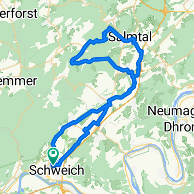
A cycling route starting in Schweich, Rhineland-Palatinate, Germany.
Overview
About this route
The route includes some nice climbs, not overly steep, but quite suitable for 'a quick lap to power up'. Provided the paths are reasonably dry, the route is also suitable for a cyclocross bike. A short singletrack of about 100 meters descends quite steeply, but can be bypassed if necessary. This is the spot where, at the highest point of the route, you turn left off the forest path onto an unpaved trail – just stay on the forest path and take the next left.
- -:--
- Duration
- 12.7 km
- Distance
- 258 m
- Ascent
- 259 m
- Descent
- ---
- Avg. speed
- ---
- Max. altitude
Route quality
Waytypes & surfaces along the route
Waytypes
Track
8.2 km
(65 %)
Quiet road
2.7 km
(21 %)
Surfaces
Paved
4.6 km
(36 %)
Unpaved
6.9 km
(54 %)
Gravel
6.5 km
(51 %)
Asphalt
4.1 km
(32 %)
Continue with Bikemap
Use, edit, or download this cycling route
You would like to ride nette Runde zum schnell mal auspowern or customize it for your own trip? Here is what you can do with this Bikemap route:
Free features
- Save this route as favorite or in collections
- Copy & plan your own version of this route
- Sync your route with Garmin or Wahoo
Premium features
Free trial for 3 days, or one-time payment. More about Bikemap Premium.
- Navigate this route on iOS & Android
- Export a GPX / KML file of this route
- Create your custom printout (try it for free)
- Download this route for offline navigation
Discover more Premium features.
Get Bikemap PremiumFrom our community
Other popular routes starting in Schweich
 nette Runde zum schnell mal auspowern
- Distance
- 12.7 km
- Ascent
- 258 m
- Descent
- 259 m
- Location
- Schweich, Rhineland-Palatinate, Germany
 Moselhöhenweg
- Distance
- 10.1 km
- Ascent
- 193 m
- Descent
- 196 m
- Location
- Schweich, Rhineland-Palatinate, Germany
 Rhein-Pfalz-Saar-Tour 2008 Pt5
- Distance
- 87.2 km
- Ascent
- 247 m
- Descent
- 173 m
- Location
- Schweich, Rhineland-Palatinate, Germany
 Ruwer
Ruwer- Distance
- 12.7 km
- Ascent
- 78 m
- Descent
- 59 m
- Location
- Schweich, Rhineland-Palatinate, Germany
 Quint-Kaiserhammer-Kordel-Daufenbach-Naurath-Föhren-Schweich
- Distance
- 43.6 km
- Ascent
- 485 m
- Descent
- 485 m
- Location
- Schweich, Rhineland-Palatinate, Germany
 Schweich-Dodenburg-Salmtal-Schweich
- Distance
- 45 km
- Ascent
- 358 m
- Descent
- 359 m
- Location
- Schweich, Rhineland-Palatinate, Germany
 Schweich-Ehrang-Bausch-Weisshauswald-Altenhof-BurgRamstein-Schweich
- Distance
- 38.6 km
- Ascent
- 643 m
- Descent
- 646 m
- Location
- Schweich, Rhineland-Palatinate, Germany
 Meulenwald Trail 1
- Distance
- 23.5 km
- Ascent
- 481 m
- Descent
- 481 m
- Location
- Schweich, Rhineland-Palatinate, Germany
Open it in the app