

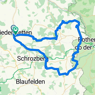
Kleine Übungsrunde
A cycling route starting in Niederstetten, Baden-Württemberg, Germany.
Overview
About this route
30.5.2009
Niederstetten, Akazienstraße
Niederstetten, privater Flugplatz
Wildentierbach raus, Richtung Rinderfeld
links abgebogen am Wald Richtung Wermutshausen
über Rehhof zurück
teils Asphalt
teils unbefestigter Waldweg und Schotter
- -:--
- Duration
- 12.4 km
- Distance
- 309 m
- Ascent
- 313 m
- Descent
- ---
- Avg. speed
- ---
- Max. altitude

Continue with Bikemap
Use, edit, or download this cycling route
You would like to ride Kleine Übungsrunde or customize it for your own trip? Here is what you can do with this Bikemap route:
Free features
- Save this route as favorite or in collections
- Copy & plan your own version of this route
- Sync your route with Garmin or Wahoo
Premium features
Free trial for 3 days, or one-time payment. More about Bikemap Premium.
- Navigate this route on iOS & Android
- Export a GPX / KML file of this route
- Create your custom printout (try it for free)
- Download this route for offline navigation
Discover more Premium features.
Get Bikemap PremiumFrom our community
Other popular routes starting in Niederstetten
 Niederstetten - Oberrimbach - Niederstetten
- Distance
- 31.9 km
- Ascent
- 330 m
- Descent
- 280 m
- Location
- Niederstetten, Baden-Württemberg, Germany
 Kleine Übungsrunde
- Distance
- 12.4 km
- Ascent
- 309 m
- Descent
- 313 m
- Location
- Niederstetten, Baden-Württemberg, Germany
 Niederstetten, Akazienstr. über Pfitzingen nach Weikersheim
- Distance
- 14.1 km
- Ascent
- 192 m
- Descent
- 273 m
- Location
- Niederstetten, Baden-Württemberg, Germany
 Mai Tour 60 km
- Distance
- 58.9 km
- Ascent
- 742 m
- Descent
- 697 m
- Location
- Niederstetten, Baden-Württemberg, Germany
 Modellflugplatz Weikersheim
- Distance
- 36.6 km
- Ascent
- 502 m
- Descent
- 587 m
- Location
- Niederstetten, Baden-Württemberg, Germany
 Flugplatzrunde
- Distance
- 15 km
- Ascent
- 175 m
- Descent
- 117 m
- Location
- Niederstetten, Baden-Württemberg, Germany
 Niederstetten Taubertal (4 Berge)
- Distance
- 59.3 km
- Ascent
- 827 m
- Descent
- 803 m
- Location
- Niederstetten, Baden-Württemberg, Germany
 Niederstetten - Rothenburg - Mergentheim - Niederstetten
- Distance
- 108 km
- Ascent
- 811 m
- Descent
- 808 m
- Location
- Niederstetten, Baden-Württemberg, Germany
Open it in the app