

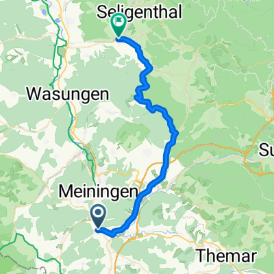
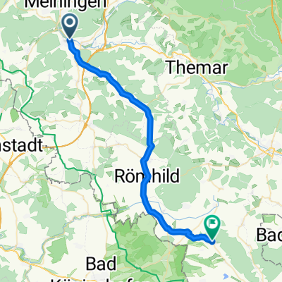
ufeld-dillstädt-marisfeld-vachdorf-ufeld
A cycling route starting in Untermaßfeld, Thuringia, Germany.
Overview
About this route
zwei kurze Anstiege nach Dillstädt und Marisfeld, ziemlich locker zu fahren
- -:--
- Duration
- 33.7 km
- Distance
- 272 m
- Ascent
- 241 m
- Descent
- ---
- Avg. speed
- 451 m
- Max. altitude
Route quality
Waytypes & surfaces along the route
Waytypes
Busy road
20.1 km
(60 %)
Quiet road
5.4 km
(16 %)
Surfaces
Paved
24.3 km
(72 %)
Unpaved
2.2 km
(6 %)
Asphalt
24.3 km
(72 %)
Gravel
1.6 km
(5 %)
Continue with Bikemap
Use, edit, or download this cycling route
You would like to ride ufeld-dillstädt-marisfeld-vachdorf-ufeld or customize it for your own trip? Here is what you can do with this Bikemap route:
Free features
- Save this route as favorite or in collections
- Copy & plan your own version of this route
- Sync your route with Garmin or Wahoo
Premium features
Free trial for 3 days, or one-time payment. More about Bikemap Premium.
- Navigate this route on iOS & Android
- Export a GPX / KML file of this route
- Create your custom printout (try it for free)
- Download this route for offline navigation
Discover more Premium features.
Get Bikemap PremiumFrom our community
Other popular routes starting in Untermaßfeld
 Walkmühlenweg, Meiningen nach Backhausgasse 7, Grabfeld
- Distance
- 6.7 km
- Ascent
- 215 m
- Descent
- 136 m
- Location
- Untermaßfeld, Thuringia, Germany
 ufeld-schmalle
- Distance
- 34.3 km
- Ascent
- 233 m
- Descent
- 137 m
- Location
- Untermaßfeld, Thuringia, Germany
 Tour2010-Tag3 (Untermaßfeld-Kronach)
- Distance
- 97.1 km
- Ascent
- 567 m
- Descent
- 522 m
- Location
- Untermaßfeld, Thuringia, Germany
 Untermaßfeld-OberhofBhf-Untermaßfeld
- Distance
- 42.7 km
- Ascent
- 418 m
- Descent
- 128 m
- Location
- Untermaßfeld, Thuringia, Germany
 ufeld-haubinda
- Distance
- 32.5 km
- Ascent
- 155 m
- Descent
- 116 m
- Location
- Untermaßfeld, Thuringia, Germany
 untermaßfeld-hohe rhön-untermaßfeld
- Distance
- 83.7 km
- Ascent
- 1,174 m
- Descent
- 1,112 m
- Location
- Untermaßfeld, Thuringia, Germany
 Teichstraße 9, Untermaßfeld nach Neumarktstraße 51, Metzels
- Distance
- 20.7 km
- Ascent
- 226 m
- Descent
- 50 m
- Location
- Untermaßfeld, Thuringia, Germany
 ufeld-dillstädt-marisfeld-vachdorf-ufeld
- Distance
- 33.7 km
- Ascent
- 272 m
- Descent
- 241 m
- Location
- Untermaßfeld, Thuringia, Germany
Open it in the app