

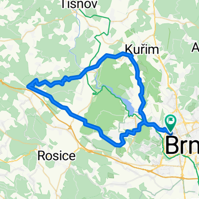
Svratecká stezka Pisárky- Bystrc(přístaviště)
A cycling route starting in Brno, South Moravian, Czechia.
Overview
About this route
- -:--
- Duration
- 7.4 km
- Distance
- 70 m
- Ascent
- 48 m
- Descent
- ---
- Avg. speed
- ---
- Max. altitude

Route quality
Waytypes & surfaces along the route
Waytypes
Cycleway
2.4 km
(33 %)
Access road
2.4 km
(32 %)
Surfaces
Paved
6.7 km
(90 %)
Asphalt
6.7 km
(90 %)
Undefined
0.7 km
(10 %)
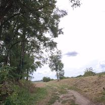
Route highlights
Points of interest along the route
\"")
Point of interest after 2.9 km
\"")
Point of interest after 3.1 km
\"")
Point of interest after 4.4 km
\"")
Point of interest after 4.5 km
\"")
Point of interest after 4.6 km
\"")
Point of interest after 4.6 km
\"")
Point of interest after 4.7 km
\"")
Point of interest after 4.9 km
\"")
Point of interest after 5 km
Continue with Bikemap
Use, edit, or download this cycling route
You would like to ride Svratecká stezka Pisárky- Bystrc(přístaviště) or customize it for your own trip? Here is what you can do with this Bikemap route:
Free features
- Save this route as favorite or in collections
- Copy & plan your own version of this route
- Sync your route with Garmin or Wahoo
Premium features
Free trial for 3 days, or one-time payment. More about Bikemap Premium.
- Navigate this route on iOS & Android
- Export a GPX / KML file of this route
- Create your custom printout (try it for free)
- Download this route for offline navigation
Discover more Premium features.
Get Bikemap PremiumFrom our community
Other popular routes starting in Brno
 Jánská, Brno to Erbenova, Hlinsko
- Distance
- 112.9 km
- Ascent
- 1,975 m
- Descent
- 1,642 m
- Location
- Brno, South Moravian, Czechia
 Lomená-Rebešky-Rajhrad-Židlochovice a Zpět
- Distance
- 39.5 km
- Ascent
- 71 m
- Descent
- 117 m
- Location
- Brno, South Moravian, Czechia
 Lomená 36B do Lomená 36B
- Distance
- 17 km
- Ascent
- 40 m
- Descent
- 84 m
- Location
- Brno, South Moravian, Czechia
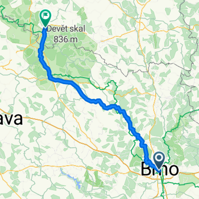
 Křtiny - max nastoupaných metrů na krátkou vzdálenost
- Distance
- 64.8 km
- Ascent
- 1,524 m
- Descent
- 1,424 m
- Location
- Brno, South Moravian, Czechia
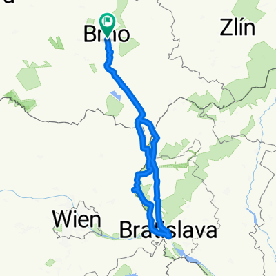 Brno -Bratislava-Brno
- Distance
- 303.1 km
- Ascent
- 213 m
- Descent
- 213 m
- Location
- Brno, South Moravian, Czechia
 Wien - Brünn - Prag - Dresden über Tsch. Radweg 4 und 1
- Distance
- 434.6 km
- Ascent
- 1,381 m
- Descent
- 1,475 m
- Location
- Brno, South Moravian, Czechia
 Start - Lap 1 - Lap 2 - Lap 3 - Lap 4 - Lap 5 - Lap 6 - Lap 7 - Lap 8 - Lap 9 - Lap 10 - Lap 11 - Lap 12 - End
- Distance
- 55.4 km
- Ascent
- 1,368 m
- Descent
- 1,365 m
- Location
- Brno, South Moravian, Czechia
 Lužánky - Holubice - Šaratice - Sokolnice - Lužánky
- Distance
- 49.4 km
- Ascent
- 249 m
- Descent
- 258 m
- Location
- Brno, South Moravian, Czechia
Open it in the app