

ADFC-Rennradtour Blankenfelde-Wittenberg und zurück
A cycling route starting in Rangsdorf, Brandenburg, Germany.
Overview
About this route
ridden on 30.03.2008
- -:--
- Duration
- 209.2 km
- Distance
- 489 m
- Ascent
- 490 m
- Descent
- ---
- Avg. speed
- 129 m
- Max. altitude
Route quality
Waytypes & surfaces along the route
Waytypes
Road
48.1 km
(23 %)
Quiet road
31.4 km
(15 %)
Surfaces
Paved
167.4 km
(80 %)
Unpaved
6.3 km
(3 %)
Asphalt
163.2 km
(78 %)
Ground
4.2 km
(2 %)
Continue with Bikemap
Use, edit, or download this cycling route
You would like to ride ADFC-Rennradtour Blankenfelde-Wittenberg und zurück or customize it for your own trip? Here is what you can do with this Bikemap route:
Free features
- Save this route as favorite or in collections
- Copy & plan your own version of this route
- Split it into stages to create a multi-day tour
- Sync your route with Garmin or Wahoo
Premium features
Free trial for 3 days, or one-time payment. More about Bikemap Premium.
- Navigate this route on iOS & Android
- Export a GPX / KML file of this route
- Create your custom printout (try it for free)
- Download this route for offline navigation
Discover more Premium features.
Get Bikemap PremiumFrom our community
Other popular routes starting in Rangsdorf
 ADFC-Rennradtour Blankenfelde-Wittenberg und zurück
- Distance
- 209.2 km
- Ascent
- 489 m
- Descent
- 490 m
- Location
- Rangsdorf, Brandenburg, Germany
 Café 45überNull
- Distance
- 25.7 km
- Ascent
- 55 m
- Descent
- 49 m
- Location
- Rangsdorf, Brandenburg, Germany
 01. Mai Fahrt 2020
- Distance
- 40.3 km
- Ascent
- 73 m
- Descent
- 71 m
- Location
- Rangsdorf, Brandenburg, Germany
 Rund um Ludwigsfelde
- Distance
- 72.3 km
- Ascent
- 143 m
- Descent
- 143 m
- Location
- Rangsdorf, Brandenburg, Germany
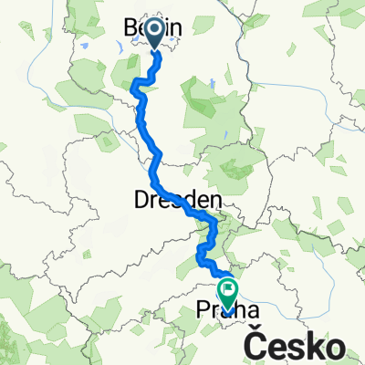 Berlin - Praha
- Distance
- 426.9 km
- Ascent
- 2,014 m
- Descent
- 1,852 m
- Location
- Rangsdorf, Brandenburg, Germany
 Weinberg
- Distance
- 8.4 km
- Ascent
- 93 m
- Descent
- 92 m
- Location
- Rangsdorf, Brandenburg, Germany
 Motzener See
- Distance
- 60.1 km
- Ascent
- 78 m
- Descent
- 80 m
- Location
- Rangsdorf, Brandenburg, Germany
 Blankenfelde - Sperenberg - Blankenfelde
- Distance
- 58 km
- Ascent
- 102 m
- Descent
- 100 m
- Location
- Rangsdorf, Brandenburg, Germany
Open it in the app