

TDFEtape 3
A cycling route starting in Osséja, Occitanie, France.
Overview
About this route
- -:--
- Duration
- 92 km
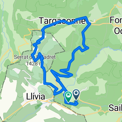
- Distance
- 1,295 m
- Ascent
- 2,335 m
- Descent
- ---
- Avg. speed
- ---
- Max. altitude
Route quality
Waytypes & surfaces along the route
Waytypes
Cycleway
8.3 km
(9 %)
Quiet road
6.4 km
(7 %)
Surfaces
Paved
48.8 km
(53 %)
Unpaved
0.9 km
(1 %)
Asphalt
48.8 km
(53 %)
Ground
0.9 km
(1 %)
Undefined
42.3 km
(46 %)
Route highlights
Points of interest along the route
Point of interest after 64.3 km
Continue with Bikemap
Use, edit, or download this cycling route
You would like to ride TDFEtape 3 or customize it for your own trip? Here is what you can do with this Bikemap route:
Free features
- Save this route as favorite or in collections
- Copy & plan your own version of this route
- Split it into stages to create a multi-day tour
- Sync your route with Garmin or Wahoo
Premium features
Free trial for 3 days, or one-time payment. More about Bikemap Premium.
- Navigate this route on iOS & Android
- Export a GPX / KML file of this route
- Create your custom printout (try it for free)
- Download this route for offline navigation
Discover more Premium features.
Get Bikemap PremiumFrom our community
Other popular routes starting in Osséja
 Tour villages SUD
- Distance
- 45.2 km
- Ascent
- 1,129 m
- Descent
- 1,129 m
- Location
- Osséja, Occitanie, France
 Sallagosa-Baltarga-Sallagosa
- Distance
- 56 km
- Ascent
- 389 m
- Descent
- 476 m
- Location
- Osséja, Occitanie, France
 Perche,Les Angles, Creu , LLose
- Distance
- 46.4 km
- Ascent
- 1,028 m
- Descent
- 1,023 m
- Location
- Osséja, Occitanie, France
 Ariège Est 21
- Distance
- 518.4 km
- Ascent
- 8,555 m
- Descent
- 9,036 m
- Location
- Osséja, Occitanie, France
 TDFEtape 3
- Distance
- 92 km
- Ascent
- 1,295 m
- Descent
- 2,335 m
- Location
- Osséja, Occitanie, France
 Estavar à Camí del Sègre, Estavar
- Distance
- 19.7 km
- Ascent
- 553 m
- Descent
- 557 m
- Location
- Osséja, Occitanie, France
 De Rue d'Espagne 26, Palau-de-Cerdagne a Route sans nom, Osséja
- Distance
- 9.8 km
- Ascent
- 934 m
- Descent
- 25 m
- Location
- Osséja, Occitanie, France
 Descente Train Jaune
- Distance
- 24.5 km
- Ascent
- 601 m
- Descent
- 1,504 m
- Location
- Osséja, Occitanie, France
Open it in the app