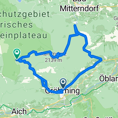
Dachsteinrunde Blau 2
A cycling route starting in Gröbming, Styria, Austria.
Overview
About this route
Dachsteinrunde Blau 2. Etappe mit Ziel Salzburger Dolomitenhof
- -:--
- Duration
- 65.9 km
- Distance
- 1,482 m
- Ascent
- 1,343 m
- Descent
- ---
- Avg. speed
- ---
- Avg. speed
Route quality
Waytypes & surfaces along the route
Waytypes
Track
29.7 km
(45 %)
Quiet road
12.1 km
(18 %)
Surfaces
Paved
24.4 km
(37 %)
Unpaved
35.2 km
(53 %)
Gravel
29 km
(44 %)
Asphalt
24.2 km
(37 %)
Continue with Bikemap
Use, edit, or download this cycling route
You would like to ride Dachsteinrunde Blau 2 or customize it for your own trip? Here is what you can do with this Bikemap route:
Free features
- Save this route as favorite or in collections
- Copy & plan your own version of this route
- Sync your route with Garmin or Wahoo
Premium features
Free trial for 3 days, or one-time payment. More about Bikemap Premium.
- Navigate this route on iOS & Android
- Export a GPX / KML file of this route
- Create your custom printout (try it for free)
- Download this route for offline navigation
Discover more Premium features.
Get Bikemap PremiumFrom our community
Other popular routes starting in Gröbming
- Dachsteinrunde 2. Etappe
- Distance
- 65.5 km
- Ascent
- 1,394 m
- Descent
- 1,351 m
- Location
- Gröbming, Styria, Austria
- Rund um den Dachstein
- Distance
- 161.9 km
- Ascent
- 1,534 m
- Descent
- 1,534 m
- Location
- Gröbming, Styria, Austria
- Moosheim-Stoderzinken
- Distance
- 16 km
- Ascent
- 1,205 m
- Descent
- 143 m
- Location
- Gröbming, Styria, Austria
- Kranzbach, Mitterberg-Sankt Martin nach Bad Mitterndorf 30, Bad Mitterndorf
- Distance
- 32.8 km
- Ascent
- 895 m
- Descent
- 834 m
- Location
- Gröbming, Styria, Austria
- Dachsteinrunde BlauSchwarz
- Distance
- 218.2 km
- Ascent
- 4,000 m
- Descent
- 4,000 m
- Location
- Gröbming, Styria, Austria
- Kaindorf-Gröbming-Stoderzinken
- Distance
- 30.2 km
- Ascent
- 1,122 m
- Descent
- 1,122 m
- Location
- Gröbming, Styria, Austria
- Dachsteinrunde 2
- Distance
- 76 km
- Ascent
- 2,262 m
- Descent
- 1,880 m
- Location
- Gröbming, Styria, Austria
- Bachweg 1006, Gröbming nach Wamprechtsamerstraße 1004, Gröbming
- Distance
- 40.6 km
- Ascent
- 937 m
- Descent
- 936 m
- Location
- Gröbming, Styria, Austria
Open it in the app