

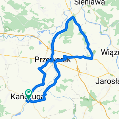
Kańczuga Łopuszka Manasterz SIetesz. Podparpackie pogórze
A cycling route starting in Kańczuga, Subcarpathian Voivodeship, Poland.
Overview
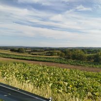
About this route
Several ascents:
Forest in Ł.Wielkiej,
Manasterz-Nieważka
Pass through the Hucisko Nature Reserve.
Fast descent from Hucisko-Lipnik-Sietesz
Asphalt route 97% 3% off-road
- -:--
- Duration
- 38.8 km
- Distance
- 470 m
- Ascent
- 470 m
- Descent
- ---
- Avg. speed
- ---
- Max. altitude

Route quality
Waytypes & surfaces along the route
Waytypes
Road
22.1 km
(57 %)
Quiet road
4.3 km
(11 %)
Surfaces
Paved
32.6 km
(84 %)
Unpaved
1.2 km
(3 %)
Asphalt
32.6 km
(84 %)
Gravel
0.8 km
(2 %)
Route highlights
Points of interest along the route
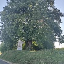
Point of interest after 38.8 km
Start z Kańczugi
Continue with Bikemap
Use, edit, or download this cycling route
You would like to ride Kańczuga Łopuszka Manasterz SIetesz. Podparpackie pogórze or customize it for your own trip? Here is what you can do with this Bikemap route:
Free features
- Save this route as favorite or in collections
- Copy & plan your own version of this route
- Sync your route with Garmin or Wahoo
Premium features
Free trial for 3 days, or one-time payment. More about Bikemap Premium.
- Navigate this route on iOS & Android
- Export a GPX / KML file of this route
- Create your custom printout (try it for free)
- Download this route for offline navigation
Discover more Premium features.
Get Bikemap PremiumFrom our community
Other popular routes starting in Kańczuga
 Zielona do Węgierska 39A
- Distance
- 19 km
- Ascent
- 163 m
- Descent
- 204 m
- Location
- Kańczuga, Subcarpathian Voivodeship, Poland
 # 3 GSR "EDU 9"
- Distance
- 43.2 km
- Ascent
- 380 m
- Descent
- 388 m
- Location
- Kańczuga, Subcarpathian Voivodeship, Poland
 130 (55/16) Rudołowice-Radymno-Wiązownica-Radawa-Sieniawa-Przeworsk
- Distance
- 133.9 km
- Ascent
- 258 m
- Descent
- 260 m
- Location
- Kańczuga, Subcarpathian Voivodeship, Poland
 #2 GSR "Junior"
- Distance
- 17.3 km
- Ascent
- 145 m
- Descent
- 137 m
- Location
- Kańczuga, Subcarpathian Voivodeship, Poland
 113/SIENIAWA-KURYŁÓWKA-ŁAŃCUT
- Distance
- 113.4 km
- Ascent
- 261 m
- Descent
- 261 m
- Location
- Kańczuga, Subcarpathian Voivodeship, Poland
 Szkolna do Wolności
- Distance
- 21 km
- Ascent
- 225 m
- Descent
- 276 m
- Location
- Kańczuga, Subcarpathian Voivodeship, Poland
 68 km Gminny Szlak Rowerowy "K-ga Max" (Kańczucka pętla)
- Distance
- 68.2 km
- Ascent
- 710 m
- Descent
- 715 m
- Location
- Kańczuga, Subcarpathian Voivodeship, Poland
 65 (64/16) Przeworsk-Tryńcza-Pełkinie-Krzeczowice
- Distance
- 64.6 km
- Ascent
- 134 m
- Descent
- 134 m
- Location
- Kańczuga, Subcarpathian Voivodeship, Poland
Open it in the app