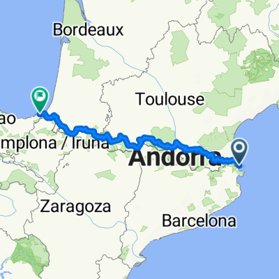
Raid Pyrenees - One
- 826.2 km
- 9,943 m
- 9,680 m
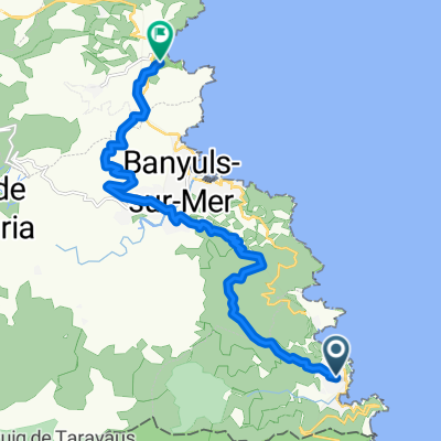
- Cervera de la Marenda, Occitanie, France
A cycling route starting in Cervera de la Marenda, Occitanie, France.
Overview
Distance: 62.3 km (38.7 mi)
Difficulty: Medium
Time: 5 - 6 hours
Climbs: 2
Meters/Feet Climbed: 880 m (2887 ft)
Max/Min Altitude: 375 / 0 m (1230 / 0 ft)
Average Grade: 1.36%
Percent Climb Distance: 29%
Climb #1
Distance: 6.2 km (3.8 mi)
Elevation Gain: 240 m (787 ft)
Average Slope: 3.87%
Climb #2
Distance: 12 km (7.5 mi)
Elevation Gain: 300 m (984 ft)
Average Slope: 4.3%
created this 12 years ago
Route quality
Road
17.2 km
(27 %)
Quiet road
10.2 km
(16 %)
Paved
40.7 km
(64 %)
Unpaved
0.6 km
(1 %)
Asphalt
40.7 km
(64 %)
Gravel
0.6 km
(1 %)
Undefined
22.3 km
(35 %)
Continue with Bikemap
You would like to ride FR Riding the Pyrenees Al1.0 - Cerbère to Le Boulou or customize it for your own trip? Here is what you can do with this Bikemap route:
Free trial for 3 days, or one-time payment. More about Bikemap Premium.
Discover more Premium features.
Get Bikemap PremiumFrom our community
Open it in the app