

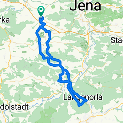
Döbritschen/Vesser
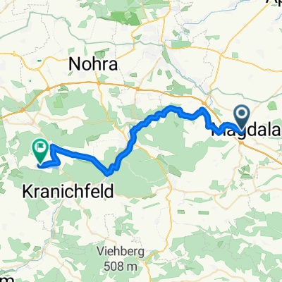
A cycling route starting in Magdala, Thuringia, Germany.
Overview
About this route
Bergig(Rennsteig)
- -:--
- Duration
- 86.1 km
- Distance
- 810 m
- Ascent
- 508 m
- Descent
- ---
- Avg. speed
- ---
- Max. altitude

Route quality
Waytypes & surfaces along the route
Waytypes
Road
13.8 km
(16 %)
Quiet road
6.9 km
(8 %)
Surfaces
Paved
79.2 km
(92 %)
Unpaved
0.9 km
(1 %)
Asphalt
78.3 km
(91 %)
Paved (undefined)
0.9 km
(1 %)
Route highlights
Points of interest along the route
Point of interest after 6.1 km
Continue with Bikemap
Use, edit, or download this cycling route
You would like to ride Döbritschen/Vesser or customize it for your own trip? Here is what you can do with this Bikemap route:
Free features
- Save this route as favorite or in collections
- Copy & plan your own version of this route
- Split it into stages to create a multi-day tour
- Sync your route with Garmin or Wahoo
Premium features
Free trial for 3 days, or one-time payment. More about Bikemap Premium.
- Navigate this route on iOS & Android
- Export a GPX / KML file of this route
- Create your custom printout (try it for free)
- Download this route for offline navigation
Discover more Premium features.
Get Bikemap PremiumFrom our community
Other popular routes starting in Magdala
 Route zu Steigerwald Stadium
- Distance
- 37.4 km
- Ascent
- 502 m
- Descent
- 565 m
- Location
- Magdala, Thuringia, Germany
 Magdala - Eiserne Hand - Magdala
- Distance
- 66.3 km
- Ascent
- 1,292 m
- Descent
- 1,294 m
- Location
- Magdala, Thuringia, Germany
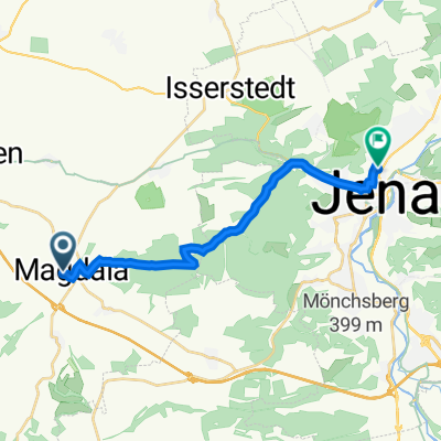 Ottstedter Straße, Magdala nach Dornburger Straße 26, Jena
- Distance
- 14.5 km
- Ascent
- 387 m
- Descent
- 526 m
- Location
- Magdala, Thuringia, Germany
 Lohmaer Straße, Magdala nach Kleiner Anger, Magdala
- Distance
- 63.9 km
- Ascent
- 1,184 m
- Descent
- 1,189 m
- Location
- Magdala, Thuringia, Germany
 Reinstädt nach Ottstedter Straße, Magdala
- Distance
- 13.6 km
- Ascent
- 246 m
- Descent
- 114 m
- Location
- Magdala, Thuringia, Germany
 Döbritschen/Vesser
- Distance
- 86.1 km
- Ascent
- 810 m
- Descent
- 508 m
- Location
- Magdala, Thuringia, Germany
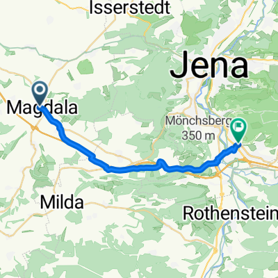 Ottstedter Straße, Magdala nach Richard-Zimmermann-Straße, Jena
- Distance
- 15.7 km
- Ascent
- 188 m
- Descent
- 284 m
- Location
- Magdala, Thuringia, Germany
 Lohmaer Straße, Magdala nach Im Dorfe, Hohenfelden
- Distance
- 30.7 km
- Ascent
- 395 m
- Descent
- 347 m
- Location
- Magdala, Thuringia, Germany
Open it in the app