

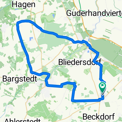
0 2013 Waldroute Altes Land
A cycling route starting in Apensen, Lower Saxony, Germany.
Overview
About this route
The Geest landscape around Apensen with its moor and forest areas is an ancient settlement area. This is evidenced by the millennia-old barrow graves. From the 65-meter high Litberg observation tower, you can enjoy the view before the 'forest-rich' tour continues.
Signage: Forest Route logo
See and Experience: Forests: Braken and Wiegerser Forst, Harsefeld Monastery Park, Sauensiek natural swimming pool, Litberg with observation tower, historic farm complex Beekhoff in Beckdorf, Goldbeck barrow grave field More information: Samtgemeinde Apensen and Tourist-Info Harsefeld
- -:--
- Duration
- 46.3 km
- Distance
- 106 m
- Ascent
- 107 m
- Descent
- ---
- Avg. speed
- ---
- Max. altitude
Route quality
Waytypes & surfaces along the route
Waytypes
Quiet road
17.1 km
(37 %)
Track
13 km
(28 %)
Surfaces
Paved
23.6 km
(51 %)
Unpaved
7.9 km
(17 %)
Asphalt
19 km
(41 %)
Gravel
7.4 km
(16 %)
Continue with Bikemap
Use, edit, or download this cycling route
You would like to ride 0 2013 Waldroute Altes Land or customize it for your own trip? Here is what you can do with this Bikemap route:
Free features
- Save this route as favorite or in collections
- Copy & plan your own version of this route
- Sync your route with Garmin or Wahoo
Premium features
Free trial for 3 days, or one-time payment. More about Bikemap Premium.
- Navigate this route on iOS & Android
- Export a GPX / KML file of this route
- Create your custom printout (try it for free)
- Download this route for offline navigation
Discover more Premium features.
Get Bikemap PremiumFrom our community
Other popular routes starting in Apensen
 Rundfahrt Apensen bis Deinste
- Distance
- 42.9 km
- Ascent
- 145 m
- Descent
- 149 m
- Location
- Apensen, Lower Saxony, Germany
 ApDeinsteAp
- Distance
- 52.8 km
- Ascent
- 97 m
- Descent
- 96 m
- Location
- Apensen, Lower Saxony, Germany
 Apensen am 03-08-2012
- Distance
- 30.3 km
- Ascent
- 97 m
- Descent
- 96 m
- Location
- Apensen, Lower Saxony, Germany
 Hof Tschritter Nindorf zum Stein in Heidenau u. zurück
- Distance
- 27.3 km
- Ascent
- 109 m
- Descent
- 113 m
- Location
- Apensen, Lower Saxony, Germany
 Rundtour Apensen und Appelbeck
- Distance
- 28.8 km
- Ascent
- 98 m
- Descent
- 107 m
- Location
- Apensen, Lower Saxony, Germany
 0 2013 Waldroute Altes Land
- Distance
- 46.3 km
- Ascent
- 106 m
- Descent
- 107 m
- Location
- Apensen, Lower Saxony, Germany
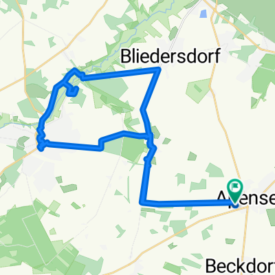
 Waldroute Urlaubsregion Altes Land am Elbstrom
- Distance
- 46.3 km
- Ascent
- 106 m
- Descent
- 107 m
- Location
- Apensen, Lower Saxony, Germany
 Rund um Apensen 01
- Distance
- 36.3 km
- Ascent
- 88 m
- Descent
- 87 m
- Location
- Apensen, Lower Saxony, Germany
Open it in the app