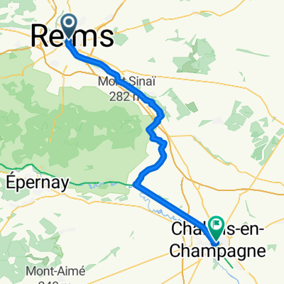
reims ay
A cycling route starting in Reims, Grand Est, France.
Overview
About this route
ee
- -:--
- Duration
- 194 km
- Distance
- 742 m
- Ascent
- 670 m
- Descent
- ---
- Avg. speed
- ---
- Max. altitude
Route quality
Waytypes & surfaces along the route
Waytypes
Busy road
117 km
(60 %)
Road
37.3 km
(19 %)
Surfaces
Paved
85.2 km
(44 %)
Unpaved
0.2 km
(<1 %)
Asphalt
82.8 km
(43 %)
Concrete
1.9 km
(<1 %)
Route highlights
Points of interest along the route
Point of interest after 97.6 km
ststop
Continue with Bikemap
Use, edit, or download this cycling route
You would like to ride reims ay or customize it for your own trip? Here is what you can do with this Bikemap route:
Free features
- Save this route as favorite or in collections
- Copy & plan your own version of this route
- Split it into stages to create a multi-day tour
- Sync your route with Garmin or Wahoo
Premium features
Free trial for 3 days, or one-time payment. More about Bikemap Premium.
- Navigate this route on iOS & Android
- Export a GPX / KML file of this route
- Create your custom printout (try it for free)
- Download this route for offline navigation
Discover more Premium features.
Get Bikemap PremiumFrom our community
Other popular routes starting in Reims
- montagne de reims sud
- Distance
- 63.9 km
- Ascent
- 454 m
- Descent
- 454 m
- Location
- Reims, Grand Est, France
- 21 Reims Verzenay
- Distance
- 44.3 km
- Ascent
- 323 m
- Descent
- 323 m
- Location
- Reims, Grand Est, France
- FDe Reims Vitry
- Distance
- 106.4 km
- Ascent
- 305 m
- Descent
- 298 m
- Location
- Reims, Grand Est, France
- De Avenue Paul Marchandeau, Reims à 3 Chaussée Saint-Martin, Reims
- Distance
- 16.3 km
- Ascent
- 53 m
- Descent
- 53 m
- Location
- Reims, Grand Est, France
- Reims-Monthermé
- Distance
- 106 km
- Ascent
- 605 m
- Descent
- 557 m
- Location
- Reims, Grand Est, France
- Girolibero: Reims e la Champagne
- Distance
- 130.9 km
- Ascent
- 806 m
- Descent
- 808 m
- Location
- Reims, Grand Est, France
- Elect'Ride II
- Distance
- 40.7 km
- Ascent
- 165 m
- Descent
- 164 m
- Location
- Reims, Grand Est, France
- Charleville-Mézières - Reims Jour
- Distance
- 90.8 km
- Ascent
- 243 m
- Descent
- 230 m
- Location
- Reims, Grand Est, France
Open it in the app