

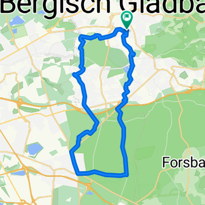
Bensberg-Wahner Heide-Rösrath-Bensberg
A cycling route starting in Bergisch Gladbach, North Rhine-Westphalia, Germany.
Overview
About this route
Tourverlauf:
Bensberg, Königsforst / Rennweg, Rösrath-Kleineichen, WahnerHeide (Wald- u. Sandwege), Rösrath-Brand, Pestalozziweg, Kölnerstr. queren, Schillerstr., links auf altem Bahndamm bis Bensberg
- -:--
- Duration
- 20.9 km
- Distance
- 99 m
- Ascent
- 140 m
- Descent
- ---
- Avg. speed
- 150 m
- Max. altitude

Route quality
Waytypes & surfaces along the route
Waytypes
Track
9.4 km
(45 %)
Quiet road
6.6 km
(32 %)
Surfaces
Paved
11.1 km
(53 %)
Unpaved
9.3 km
(44 %)
Asphalt
11.1 km
(53 %)
Gravel
4.8 km
(23 %)
Route highlights
Points of interest along the route
Point of interest after 1.8 km
Forsthaus
Point of interest after 4 km
Rennweg
Point of interest after 5.5 km
immer auf Rennweg bleiben und Rösratherstr. queren
Point of interest after 12.2 km
Radlertreff Gaststätte "Bambi" ab 11°° Uhr geöffnet (außer Mo). Bekannt für riesige Kotelett (ab 500g)
Point of interest after 17 km
alter Bahndamm
Point of interest after 19.5 km
alter Bahndamm
Point of interest after 20 km
ehem. Forsbacher Bhf
Continue with Bikemap
Use, edit, or download this cycling route
You would like to ride Bensberg-Wahner Heide-Rösrath-Bensberg or customize it for your own trip? Here is what you can do with this Bikemap route:
Free features
- Save this route as favorite or in collections
- Copy & plan your own version of this route
- Sync your route with Garmin or Wahoo
Premium features
Free trial for 3 days, or one-time payment. More about Bikemap Premium.
- Navigate this route on iOS & Android
- Export a GPX / KML file of this route
- Create your custom printout (try it for free)
- Download this route for offline navigation
Discover more Premium features.
Get Bikemap PremiumFrom our community
Other popular routes starting in Bergisch Gladbach
 Kleine Bergische Rundfahrt
- Distance
- 25.3 km
- Ascent
- 466 m
- Descent
- 453 m
- Location
- Bergisch Gladbach, North Rhine-Westphalia, Germany
 Düntalsperre über Herrenstrunden zurück
- Distance
- 43.3 km
- Ascent
- 536 m
- Descent
- 536 m
- Location
- Bergisch Gladbach, North Rhine-Westphalia, Germany
 NSU Ausfahrt
- Distance
- 22.4 km
- Ascent
- 93 m
- Descent
- 95 m
- Location
- Bergisch Gladbach, North Rhine-Westphalia, Germany
 Eine kurze Rheintour
- Distance
- 82.2 km
- Ascent
- 114 m
- Descent
- 114 m
- Location
- Bergisch Gladbach, North Rhine-Westphalia, Germany
 Bergisch Gladbach Paffrath
- Distance
- 20.7 km
- Ascent
- 91 m
- Descent
- 93 m
- Location
- Bergisch Gladbach, North Rhine-Westphalia, Germany
 Tälerroute Bergisch-Gladbach Kürten Lindlar
- Distance
- 50.8 km
- Ascent
- 618 m
- Descent
- 551 m
- Location
- Bergisch Gladbach, North Rhine-Westphalia, Germany
 Höhentour Kürten - Odenthal
- Distance
- 37.3 km
- Ascent
- 514 m
- Descent
- 517 m
- Location
- Bergisch Gladbach, North Rhine-Westphalia, Germany
 Rund um den Königsforst
- Distance
- 45.3 km
- Ascent
- 268 m
- Descent
- 268 m
- Location
- Bergisch Gladbach, North Rhine-Westphalia, Germany
Open it in the app