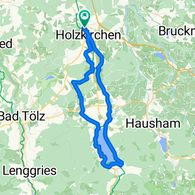
Etappe 1 Gardasee
- 132.2 km
- 495 m
- 605 m
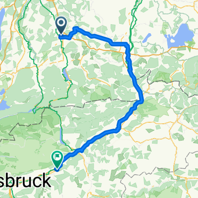
- Holzkirchen, Bavaria, Germany
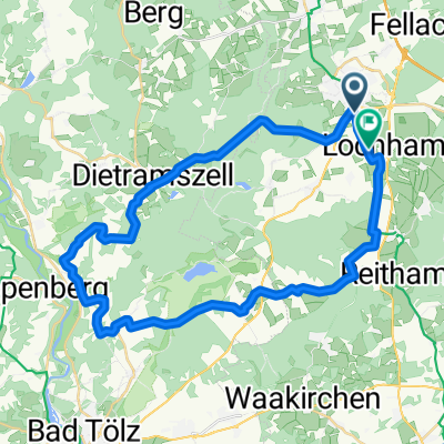
A cycling route starting in Holzkirchen, Bavaria, Germany.
Overview
Beautiful road cycling route through Dietramszell, winding along the Isar to Ascholding until the Isar bridge in WOR. Here is the turning point and back on a similar route, but via Lochen and Dietenhausen. Partially a very lonely path.
created this 12 years ago
Route quality
Quiet road
15.8 km
(28 %)
Road
3.9 km
(7 %)
Paved
55.7 km
(99 %)
Asphalt
55.7 km
(99 %)
Undefined
0.6 km
(1 %)
Route highlights
Wendepunkt auf der Isarbrücke. Hier kann man auch je nach Zeit den Flößern zugucken.
Continue with Bikemap
You would like to ride Über Dietramszell Ascholding nach WOR und zurück or customize it for your own trip? Here is what you can do with this Bikemap route:
Free trial for 3 days, or one-time payment. More about Bikemap Premium.
Discover more Premium features.
Get Bikemap PremiumFrom our community
Open it in the app