

LKT-V2
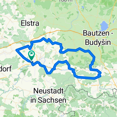
A cycling route starting in Frankenthal, Saxony, Germany.
Overview
About this route
meist auf Nebenstrassen einmal rund um den Landkreis "Sächsische Schweiz", auch teilweise über tschechisches Gebiet
- -:--
- Duration
- 271.5 km
- Distance
- 1,635 m
- Ascent
- 1,636 m
- Descent
- ---
- Avg. speed
- ---
- Max. altitude
Route quality
Waytypes & surfaces along the route
Waytypes
Road
105.9 km
(39 %)
Quiet road
40.7 km
(15 %)
Surfaces
Paved
239 km
(88 %)
Asphalt
239 km
(88 %)
Undefined
32.6 km
(12 %)
Continue with Bikemap
Use, edit, or download this cycling route
You would like to ride LKT-V2 or customize it for your own trip? Here is what you can do with this Bikemap route:
Free features
- Save this route as favorite or in collections
- Copy & plan your own version of this route
- Split it into stages to create a multi-day tour
- Sync your route with Garmin or Wahoo
Premium features
Free trial for 3 days, or one-time payment. More about Bikemap Premium.
- Navigate this route on iOS & Android
- Export a GPX / KML file of this route
- Create your custom printout (try it for free)
- Download this route for offline navigation
Discover more Premium features.
Get Bikemap PremiumFrom our community
Other popular routes starting in Frankenthal
 MTB-Tour ab Dani
- Distance
- 54.1 km
- Ascent
- 478 m
- Descent
- 478 m
- Location
- Frankenthal, Saxony, Germany
 Lausitz und Sächsische Schweiz
- Distance
- 114.4 km
- Ascent
- 637 m
- Descent
- 637 m
- Location
- Frankenthal, Saxony, Germany
 Bischofswerda - Massenei Rundtour
- Distance
- 36.5 km
- Ascent
- 269 m
- Descent
- 271 m
- Location
- Frankenthal, Saxony, Germany
 Goldbach-Luchsenburg-Ohorn-Masenei
- Distance
- 34.3 km
- Ascent
- 242 m
- Descent
- 242 m
- Location
- Frankenthal, Saxony, Germany
 Flandern Rundfahrt
- Distance
- 128.8 km
- Ascent
- 663 m
- Descent
- 664 m
- Location
- Frankenthal, Saxony, Germany
 UmStolpen60_440
- Distance
- 60 km
- Ascent
- 361 m
- Descent
- 363 m
- Location
- Frankenthal, Saxony, Germany
 10-07-13
- Distance
- 79.8 km
- Ascent
- 722 m
- Descent
- 722 m
- Location
- Frankenthal, Saxony, Germany
 Goldbach-Luxenburg-Burkau-Butterberg
- Distance
- 28.5 km
- Ascent
- 296 m
- Descent
- 296 m
- Location
- Frankenthal, Saxony, Germany
Open it in the app