

Greenhead-Corebridge (Hadrians Wall Day 2)
A cycling route starting in Greenhead, England, United Kingdom.
Overview
About this route
mostly following NCN72 (Hadrian's Wall route, adapted to see some more of the Roman sites)
- -:--
- Duration
- 58.6 km
- Distance
- 355 m
- Ascent
- 500 m
- Descent
- ---
- Avg. speed
- ---
- Max. altitude
Route quality
Waytypes & surfaces along the route
Waytypes
Quiet road
25.4 km
(43 %)
Road
17.2 km
(29 %)
Surfaces
Paved
14.1 km
(24 %)
Unpaved
0.1 km
(<1 %)
Asphalt
14.1 km
(24 %)
Ground
0.1 km
(<1 %)
Undefined
44.4 km
(76 %)
Continue with Bikemap
Use, edit, or download this cycling route
You would like to ride Greenhead-Corebridge (Hadrians Wall Day 2) or customize it for your own trip? Here is what you can do with this Bikemap route:
Free features
- Save this route as favorite or in collections
- Copy & plan your own version of this route
- Sync your route with Garmin or Wahoo
Premium features
Free trial for 3 days, or one-time payment. More about Bikemap Premium.
- Navigate this route on iOS & Android
- Export a GPX / KML file of this route
- Create your custom printout (try it for free)
- Download this route for offline navigation
Discover more Premium features.
Get Bikemap PremiumFrom our community
Other popular routes starting in Greenhead
 Greenhead-Corebridge (Hadrians Wall Day 2)
- Distance
- 58.6 km
- Ascent
- 355 m
- Descent
- 500 m
- Location
- Greenhead, England, United Kingdom
 Greenhead Cycling
- Distance
- 48.4 km
- Ascent
- 725 m
- Descent
- 734 m
- Location
- Greenhead, England, United Kingdom
 2e dag alternatief 68 km
- Distance
- 123.1 km
- Ascent
- 182 m
- Descent
- 310 m
- Location
- Greenhead, England, United Kingdom
 england-7-gilsland-newcastleton
- Distance
- 34.9 km
- Ascent
- 398 m
- Descent
- 411 m
- Location
- Greenhead, England, United Kingdom
 furls2
- Distance
- 73.9 km
- Ascent
- 345 m
- Descent
- 499 m
- Location
- Greenhead, England, United Kingdom
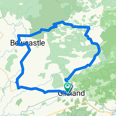 Gilsland circular via Spadeadam
- Distance
- 50.1 km
- Ascent
- 647 m
- Descent
- 653 m
- Location
- Greenhead, England, United Kingdom
 Route 3, July 2018
- Distance
- 76.8 km
- Ascent
- 1,193 m
- Descent
- 1,113 m
- Location
- Greenhead, England, United Kingdom
 Gilsland to Haltwhistle 6mi 500ft
- Distance
- 10 km
- Ascent
- 125 m
- Descent
- 104 m
- Location
- Greenhead, England, United Kingdom
Open it in the app