

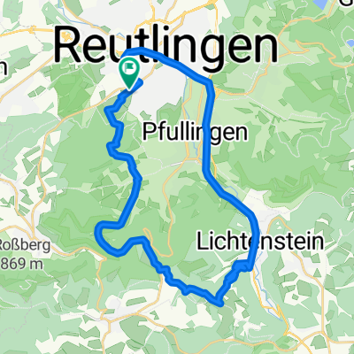
Reutlingen - Pfullinger Berg - Genkingen
A cycling route starting in Reutlingen, Baden-Wurttemberg, Germany.
Overview
About this route
Albaufstieg nahezu autofrei, ueber Ochsensteige + Gielsberg
- -:--
- Duration
- 16.5 km
- Distance
- 541 m
- Ascent
- 142 m
- Descent
- ---
- Avg. speed
- ---
- Max. altitude

Route highlights
Points of interest along the route
Point of interest after 0.7 km
Wasserhahn Carport Lerchenstr. 40
Point of interest after 9.3 km
Ochsensteige
Point of interest after 9.5 km
NSG Pfullinger Berg
Point of interest after 11.8 km
Aussichtspunkt
Point of interest after 12.2 km
Gielsberg
Point of interest after 13.8 km
Nebelhöhle
Point of interest after 14.6 km
Schartberg Pfullinger Hütte
Continue with Bikemap
Use, edit, or download this cycling route
You would like to ride Reutlingen - Pfullinger Berg - Genkingen or customize it for your own trip? Here is what you can do with this Bikemap route:
Free features
- Save this route as favorite or in collections
- Copy & plan your own version of this route
- Sync your route with Garmin or Wahoo
Premium features
Free trial for 3 days, or one-time payment. More about Bikemap Premium.
- Navigate this route on iOS & Android
- Export a GPX / KML file of this route
- Create your custom printout (try it for free)
- Download this route for offline navigation
Discover more Premium features.
Get Bikemap PremiumFrom our community
Other popular routes starting in Reutlingen
 Reutlingen Nürtingen Wendlingen 32km 110hm
- Distance
- 32.4 km
- Ascent
- 90 m
- Descent
- 217 m
- Location
- Reutlingen, Baden-Wurttemberg, Germany
 Reutlingen-Nebelhöhle
- Distance
- 29.1 km
- Ascent
- 534 m
- Descent
- 534 m
- Location
- Reutlingen, Baden-Wurttemberg, Germany
 Reutlingen - Lindenhof - Holzelfingen - Reutlingen
- Distance
- 32.2 km
- Ascent
- 408 m
- Descent
- 408 m
- Location
- Reutlingen, Baden-Wurttemberg, Germany
 Lautertal
- Distance
- 75.8 km
- Ascent
- 952 m
- Descent
- 945 m
- Location
- Reutlingen, Baden-Wurttemberg, Germany
 Albtour
- Distance
- 107.2 km
- Ascent
- 947 m
- Descent
- 950 m
- Location
- Reutlingen, Baden-Wurttemberg, Germany
 Eninger Weide
- Distance
- 15.8 km
- Ascent
- 414 m
- Descent
- 26 m
- Location
- Reutlingen, Baden-Wurttemberg, Germany
 Reutlingen - Südrunde über Stuhlsteige
- Distance
- 63.5 km
- Ascent
- 578 m
- Descent
- 578 m
- Location
- Reutlingen, Baden-Wurttemberg, Germany
 RT-Metzingen-Neuffen-Urach-Eningen-RT
- Distance
- 63.8 km
- Ascent
- 1,378 m
- Descent
- 1,216 m
- Location
- Reutlingen, Baden-Wurttemberg, Germany
Open it in the app