

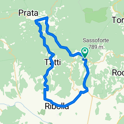
Roccastrada-R.tederighi-MassaM.
A cycling route starting in Roccastrada, Tuscany, Italy.
Overview
About this route
- -:--
- Duration
- 36.4 km
- Distance
- 631 m
- Ascent
- 698 m
- Descent
- ---
- Avg. speed
- ---
- Max. altitude

Continue with Bikemap
Use, edit, or download this cycling route
You would like to ride Roccastrada-R.tederighi-MassaM. or customize it for your own trip? Here is what you can do with this Bikemap route:
Free features
- Save this route as favorite or in collections
- Copy & plan your own version of this route
- Sync your route with Garmin or Wahoo
Premium features
Free trial for 3 days, or one-time payment. More about Bikemap Premium.
- Navigate this route on iOS & Android
- Export a GPX / KML file of this route
- Create your custom printout (try it for free)
- Download this route for offline navigation
Discover more Premium features.
Get Bikemap PremiumFrom our community
Other popular routes starting in Roccastrada
 17 agosto 24 Sagra del maccherone ;) - Donne
- Distance
- 59.3 km
- Ascent
- 329 m
- Descent
- 878 m
- Location
- Roccastrada, Tuscany, Italy
 Roccastrada-Ribolla-Ravi-Meer bei Punta Ala
- Distance
- 56.9 km
- Ascent
- 510 m
- Descent
- 973 m
- Location
- Roccastrada, Tuscany, Italy
 Rocca_Le Fomaci_Tatti_Ribolla_Montemassi_Rocca
- Distance
- 39.1 km
- Ascent
- 635 m
- Descent
- 635 m
- Location
- Roccastrada, Tuscany, Italy
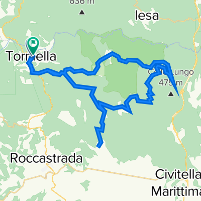
 Über Monticiano
- Distance
- 61.1 km
- Ascent
- 570 m
- Descent
- 570 m
- Location
- Roccastrada, Tuscany, Italy
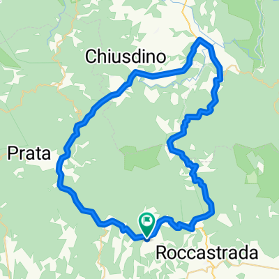
 Galgano_Chisdino_Montieri_Tatti_Roccatederighi
- Distance
- 79.1 km
- Ascent
- 793 m
- Descent
- 795 m
- Location
- Roccastrada, Tuscany, Italy
 sticciano scalo
- Distance
- 32 km
- Ascent
- 702 m
- Descent
- 781 m
- Location
- Roccastrada, Tuscany, Italy
 belagaio
- Distance
- 41.8 km
- Ascent
- 810 m
- Descent
- 828 m
- Location
- Roccastrada, Tuscany, Italy
 Roccastrada-R.tederighi-MassaM.
- Distance
- 36.4 km
- Ascent
- 631 m
- Descent
- 698 m
- Location
- Roccastrada, Tuscany, Italy
Open it in the app