

Tubize/Soignies 2008
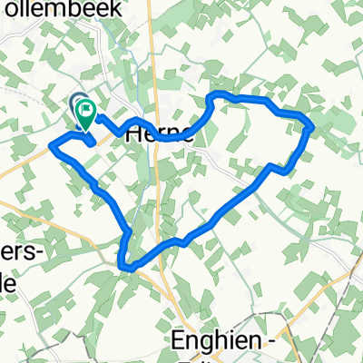
A cycling route starting in Herne, Flemish Region, Belgium.
Overview
About this route
1ère étape Tour de Wallonie 2008
- -:--
- Duration
- 37.6 km
- Distance
- 233 m
- Ascent
- 174 m
- Descent
- ---
- Avg. speed
- ---
- Max. altitude
Continue with Bikemap
Use, edit, or download this cycling route
You would like to ride Tubize/Soignies 2008 or customize it for your own trip? Here is what you can do with this Bikemap route:
Free features
- Save this route as favorite or in collections
- Copy & plan your own version of this route
- Sync your route with Garmin or Wahoo
Premium features
Free trial for 3 days, or one-time payment. More about Bikemap Premium.
- Navigate this route on iOS & Android
- Export a GPX / KML file of this route
- Create your custom printout (try it for free)
- Download this route for offline navigation
Discover more Premium features.
Get Bikemap PremiumFrom our community
Other popular routes starting in Herne
 Échappée Pajotte - Gravel 50km OFFICIEL - Échappée Pajotte - Gravel 50km OFFICIEL
- Distance
- 48.6 km
- Ascent
- 363 m
- Descent
- 363 m
- Location
- Herne, Flemish Region, Belgium
 gordel
- Distance
- 24.8 km
- Ascent
- 183 m
- Descent
- 172 m
- Location
- Herne, Flemish Region, Belgium
 Stationsstraat 58, Herne naar Stationsstraat 58, Herne
- Distance
- 11.7 km
- Ascent
- 118 m
- Descent
- 118 m
- Location
- Herne, Flemish Region, Belgium
 Route in Pajottegem
- Distance
- 11.8 km
- Ascent
- 58 m
- Descent
- 57 m
- Location
- Herne, Flemish Region, Belgium
 idg
idg- Distance
- 2 km
- Ascent
- 9 m
- Descent
- 12 m
- Location
- Herne, Flemish Region, Belgium
 Tollembeek Maubray
- Distance
- 54.6 km
- Ascent
- 174 m
- Descent
- 179 m
- Location
- Herne, Flemish Region, Belgium
 MTB-Kubus-C (Herne)
- Distance
- 38 km
- Ascent
- 178 m
- Descent
- 179 m
- Location
- Herne, Flemish Region, Belgium
 Tubize/Soignies 2008
- Distance
- 37.6 km
- Ascent
- 233 m
- Descent
- 174 m
- Location
- Herne, Flemish Region, Belgium
Open it in the app