

Kubalonka - inaczej, trudniej !
A cycling route starting in Cieszyn, Silesian Voivodeship, Poland.
Overview
About this route
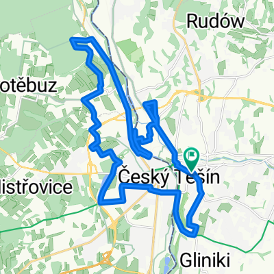
Route from Cieszyn through Goleszów, Ustroń, then along the boulevards to Wisła. From Wisła Nowa Osada, first a moderately difficult climb and then a very steep cobbled road to Kozińce. From Kozińce, a beautiful forest section to the Kubalonka Pass (761 m). And finally, a descent through the Kubalonka housing estate and a super descent through Olecki to Istebna. Beautifully through the Olza Valley to Bukowiec in the Czech Republic and then to Jabłonków and through Trzyniec back to Cieszyn.
Reaching Kubalonka from Cieszyn via Wisła and returning through Jabłonków is not difficult, but I think the variant with the described climb is rarely chosen. However, the descent through Olecki is very picturesque. I recommend it.
- -:--
- Duration
- 88.1 km
- Distance
- 714 m
- Ascent
- 714 m
- Descent
- ---
- Avg. speed
- ---
- Max. altitude

Route quality
Waytypes & surfaces along the route
Waytypes
Quiet road
32.6 km
(37 %)
Road
11.4 km
(13 %)
Surfaces
Paved
57.2 km
(65 %)
Unpaved
2.6 km
(3 %)
Asphalt
56.4 km
(64 %)
Loose gravel
1.8 km
(2 %)
Route highlights
Points of interest along the route
Point of interest after 9.9 km
źródełko
Point of interest after 56 km
źródło
Continue with Bikemap
Use, edit, or download this cycling route
You would like to ride Kubalonka - inaczej, trudniej ! or customize it for your own trip? Here is what you can do with this Bikemap route:
Free features
- Save this route as favorite or in collections
- Copy & plan your own version of this route
- Split it into stages to create a multi-day tour
- Sync your route with Garmin or Wahoo
Premium features
Free trial for 3 days, or one-time payment. More about Bikemap Premium.
- Navigate this route on iOS & Android
- Export a GPX / KML file of this route
- Create your custom printout (try it for free)
- Download this route for offline navigation
Discover more Premium features.
Get Bikemap PremiumFrom our community
Other popular routes starting in Cieszyn
 Cieszyn-Tatry-Cieszyn
- Distance
- 371.9 km
- Ascent
- 2,669 m
- Descent
- 2,669 m
- Location
- Cieszyn, Silesian Voivodeship, Poland
 Cieszyn - Czeski Cieszyn "Bunkry"
- Distance
- 22.3 km
- Ascent
- 172 m
- Descent
- 173 m
- Location
- Cieszyn, Silesian Voivodeship, Poland
 W Dolomity (12 dni) 2002r
- Distance
- 2,273.5 km
- Ascent
- 34,645 m
- Descent
- 34,441 m
- Location
- Cieszyn, Silesian Voivodeship, Poland
 Cieszyn-Dziegielow-Goleszow-Puncow-Cieszyn
- Distance
- 24.3 km
- Ascent
- 271 m
- Descent
- 276 m
- Location
- Cieszyn, Silesian Voivodeship, Poland
 Białogród i słupy graniczne
- Distance
- 80.7 km
- Ascent
- 273 m
- Descent
- 273 m
- Location
- Cieszyn, Silesian Voivodeship, Poland
 Morawka
- Distance
- 88.4 km
- Ascent
- 1,102 m
- Descent
- 1,099 m
- Location
- Cieszyn, Silesian Voivodeship, Poland
 Między Ostrawicą i Łucyną
- Distance
- 69.3 km
- Ascent
- 555 m
- Descent
- 555 m
- Location
- Cieszyn, Silesian Voivodeship, Poland
 Groniczek, Głowa konia, Filipka, Łączka
- Distance
- 58.8 km
- Ascent
- 772 m
- Descent
- 773 m
- Location
- Cieszyn, Silesian Voivodeship, Poland
Open it in the app