- 70.3 km
- 1,492 m
- 1,721 m
- Diamantina, Minas Gerais, Brazil
Diamantina-Barão de Gauicuy-12maio2013
A cycling route starting in Diamantina, Minas Gerais, Brazil.
Overview
About this route
IDA - tranquil, gentle climbs along the old train track and then a big descent. In the middle of the descent, after crossing the BR-367, there is a section about 50 m destroyed by water. You need to carry the bike.
RETURN - heavier. The route we chose for the return, shorter on the dirt road, has steeper climbs and, with the gravel, becomes more difficult for beginners. The return section along the BR has a big climb at the beginning, but the most dangerous part is the cars. The return is quicker along the BR than along the old train line.
- -:--
- Duration
- 49.3 km
- Distance
- 1,428 m
- Ascent
- 1,430 m
- Descent
- ---
- Avg. speed
- ---
- Max. altitude
Matheus Souza has bookmarked this route.
created this 13 years ago
Route highlights
Points of interest along the route

Point of interest after 7.9 km
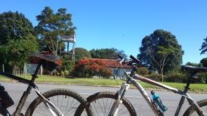
Vista do Pico do Itambé - antiga estrada de trem!
Point of interest after 14.4 km
Cruzamento da BR - parada no ponto de ônibus antes de descer para Barão de Guaicuy, para as bikes descansarem!

Point of interest after 24.4 km
Última curva antes de Barão!

Point of interest after 26.2 km
Barão de Guaicuy - Estação de Trem
Continue with Bikemap
Use, edit, or download this cycling route
You would like to ride Diamantina-Barão de Gauicuy-12maio2013 or customize it for your own trip? Here is what you can do with this Bikemap route:
Free features
- Save this route as favorite or in collections
- Copy & plan your own version of this route
- Sync your route with Garmin or Wahoo
Premium features
Free trial for 3 days, or one-time payment. More about Bikemap Premium.
- Navigate this route on iOS & Android
- Export a GPX / KML file of this route
- Create your custom printout (try it for free)
- Download this route for offline navigation
Discover more Premium features.
Get Bikemap PremiumFrom our community
Other popular routes starting in Diamantina
- Acaba Mundo e Pico do Itambé
Bandeirinha- 37.4 km
- 251 m
- 292 m
- Diamantina, Minas Gerais, Brazil
- Diamantina-Fazendo da Toca
- 13.2 km
- 268 m
- 269 m
- Diamantina, Minas Gerais, Brazil
- Corrida Rústica Juds
- 4.5 km
- 70 m
- 75 m
- Diamantina, Minas Gerais, Brazil
- Diamantina Sao Paulo (Estrada Real depois Sao Tome Campos )
- 1,212.3 km
- 3,091 m
- 3,547 m
- Diamantina, Minas Gerais, Brazil
- Estrada Real - Caminho dos Diamantes
- 406.1 km
- 3,032 m
- 3,080 m
- Diamantina, Minas Gerais, Brazil
- Trilha UFVJM-Casa dos Ventos
- 16.2 km
- 275 m
- 415 m
- Diamantina, Minas Gerais, Brazil
- Altitude Máxima
- 21.5 km
- 224 m
- 224 m
- Diamantina, Minas Gerais, Brazil
Open it in the app


