

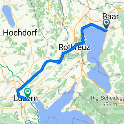
Zug - Albishorn - Affoltern - Zug
A cycling route starting in Zug, Canton of Zug, Switzerland.
Overview
About this route
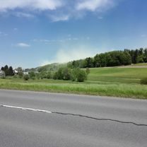
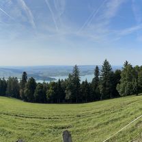
With clear visibility, a magnificent panorama: Bernese Alps, Central Swiss Alps, Glarus Alps, Säntis. See: www.alpen-panoramen.de, search: Albishorn. Route largely free of motorized traffic, in beautiful scenery. With normal bikes and mountain bikes you can continue before Baar on the right riverbank (looking downstream) and after the railway underpass on the left, on a good natural road, until the bridge to Deinikon to then continue along the route. The last 600 m to the mountain restaurant is a gravel road, but passable with a road bike. Total 720 meters of elevation gain.
Due to the route recognition, the starting point has been shifted. It is located at the destination, Lorze Brüggli (staircase underpass)
- -:--
- Duration
- 45.4 km
- Distance
- 735 m
- Ascent
- 734 m
- Descent
- ---
- Avg. speed
- 883 m
- Max. altitude
Route quality
Waytypes & surfaces along the route
Waytypes
Quiet road
22.7 km
(50 %)
Access road
7.3 km
(16 %)
Surfaces
Paved
35.4 km
(78 %)
Unpaved
0.5 km
(1 %)
Asphalt
30 km
(66 %)
Paved (undefined)
5.4 km
(12 %)
Continue with Bikemap
Use, edit, or download this cycling route
You would like to ride Zug - Albishorn - Affoltern - Zug or customize it for your own trip? Here is what you can do with this Bikemap route:
Free features
- Save this route as favorite or in collections
- Copy & plan your own version of this route
- Sync your route with Garmin or Wahoo
Premium features
Free trial for 3 days, or one-time payment. More about Bikemap Premium.
- Navigate this route on iOS & Android
- Export a GPX / KML file of this route
- Create your custom printout (try it for free)
- Download this route for offline navigation
Discover more Premium features.
Get Bikemap PremiumFrom our community
Other popular routes starting in Zug
 Lengthy Sunday Route In Zug
- Distance
- 13.8 km
- Ascent
- 769 m
- Descent
- 770 m
- Location
- Zug, Canton of Zug, Switzerland
 Zug-Trin
- Distance
- 159.9 km
- Ascent
- 2,310 m
- Descent
- 1,856 m
- Location
- Zug, Canton of Zug, Switzerland
 Trainingsroute Zug
- Distance
- 17.9 km
- Ascent
- 576 m
- Descent
- 576 m
- Location
- Zug, Canton of Zug, Switzerland
 Sihltal-Zimmerberg-Sihlmatt
- Distance
- 31.6 km
- Ascent
- 988 m
- Descent
- 982 m
- Location
- Zug, Canton of Zug, Switzerland
 Zugerberg Up+Down
- Distance
- 15.2 km
- Ascent
- 595 m
- Descent
- 595 m
- Location
- Zug, Canton of Zug, Switzerland
 Fuchsloch, Oberwil b. Zug nach Fuchsloch, Oberwil b. Zug
- Distance
- 24 km
- Ascent
- 607 m
- Descent
- 608 m
- Location
- Zug, Canton of Zug, Switzerland
 Von Zug bis Luzern
- Distance
- 30.5 km
- Ascent
- 200 m
- Descent
- 180 m
- Location
- Zug, Canton of Zug, Switzerland
 Zug-ArthGoldau-Weggis-Schwyz-Zug-80km
- Distance
- 80.7 km
- Ascent
- 687 m
- Descent
- 684 m
- Location
- Zug, Canton of Zug, Switzerland
Open it in the app